
An Insider’s Guide to New Taipei City – North Coast Districts
The North Coast of New Taipei is known for its dramatic landscapes, geological wonders, coastal cliffs, fine sand beaches, and, of course, being a hot spot for ocean recreation.
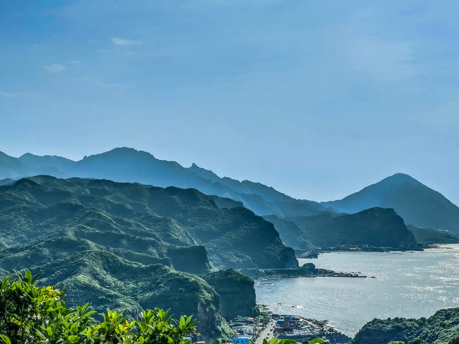
The beautiful Northern Coastal Highway (Provincial Highway No. 2) runs the length of the North Coast from New Taipei to Yilan and offers enough unbeatable views for an entire day. As it travels along the coast, the highway passes countless attractions including: numerous coastal rock formations, a handful of pristine white sandy beaches (some more secluded than others), quaint fishing ports, and several easy-to-moderate hiking trails.
The North Coast of Taiwan can be done as a day trip, and it can be combined with a trip through the Ruifang District just a little bit inland. Depending on your time constraints we offer North Coast day tours and North Coast half-day tours, both of which include a stop at the famous mountain town of Jiufen.
Continue reading for a list of the best beaches, seaside rock formations and watersports destinations (including snorkeling, diving and stand-up paddleboarding) on the North Coast.
For a more in-depth experience, please contact us with a list of your must-visit destinations and allow us to craft a customized private tour of New Taipei for you.
Yehliu Geopark
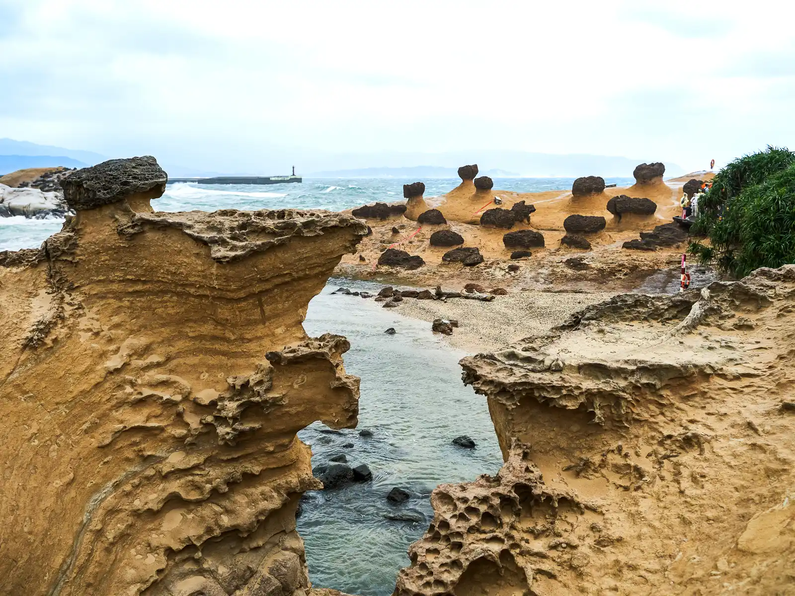
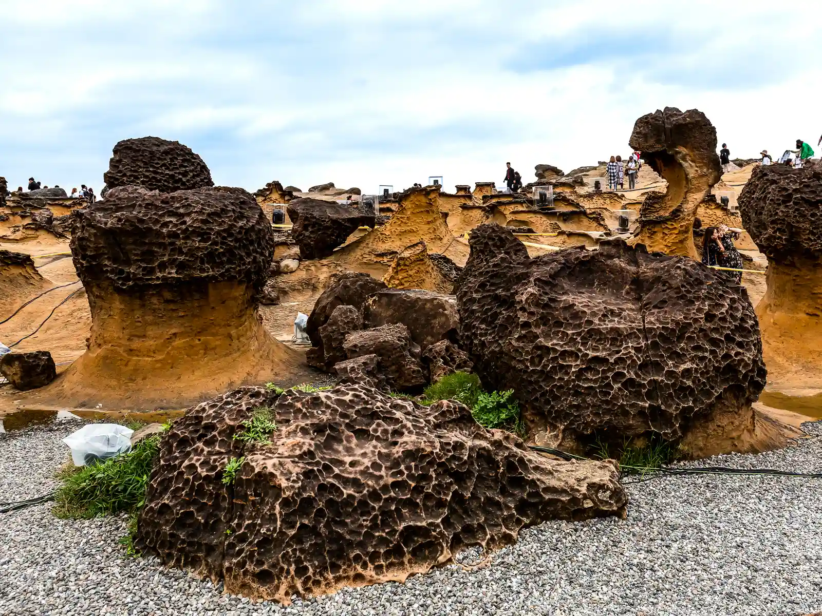
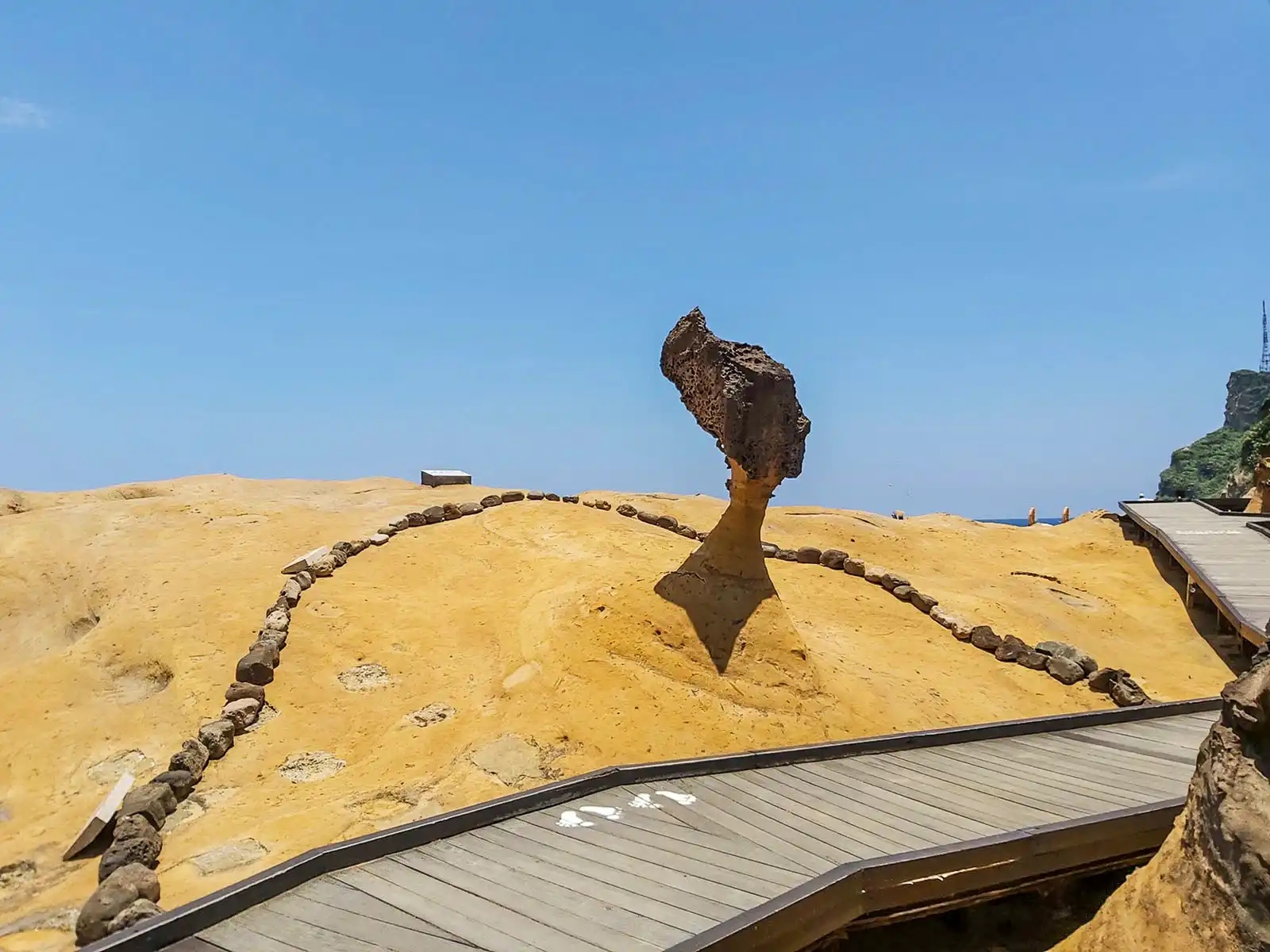
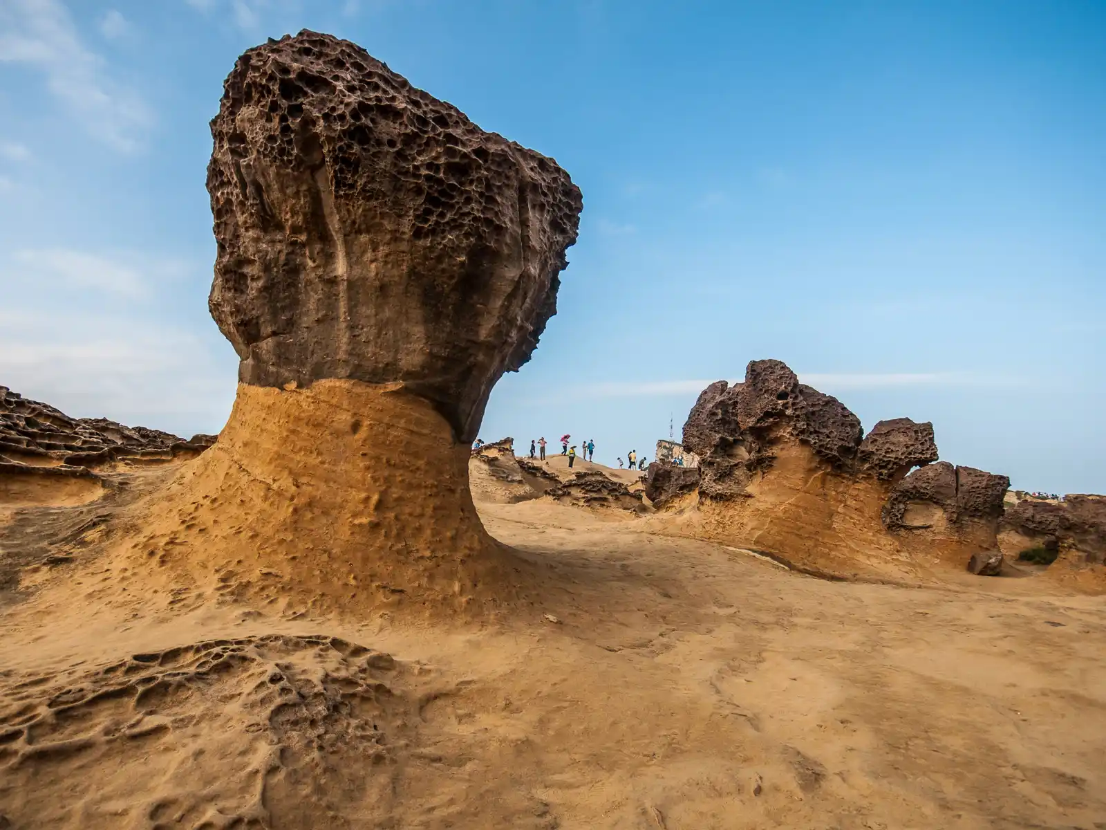
Yehliu Geopark is one of the closest coastal rock parks to Taipei, and a popular destination for tourists looking to enjoy a leisurely walk along Taiwan’s beautiful rugged coastline. The park is famous for its colorful and oddly shaped rock formations. These bright-yellow natural sandstone sculptures have inspired inventive names like “Queen’s Head”, “Fairy’s Shoe and Candle”, “Bean Curd” and “Dragon Head”.
From the park’s entrance, a one-way out-and-back trail leads through three themed sections of sculpted rocks before reaching the end of the cape. Appreciate weathered rocks, sea cliffs, caves and capes as you stroll through this entertaining classroom created by nature.
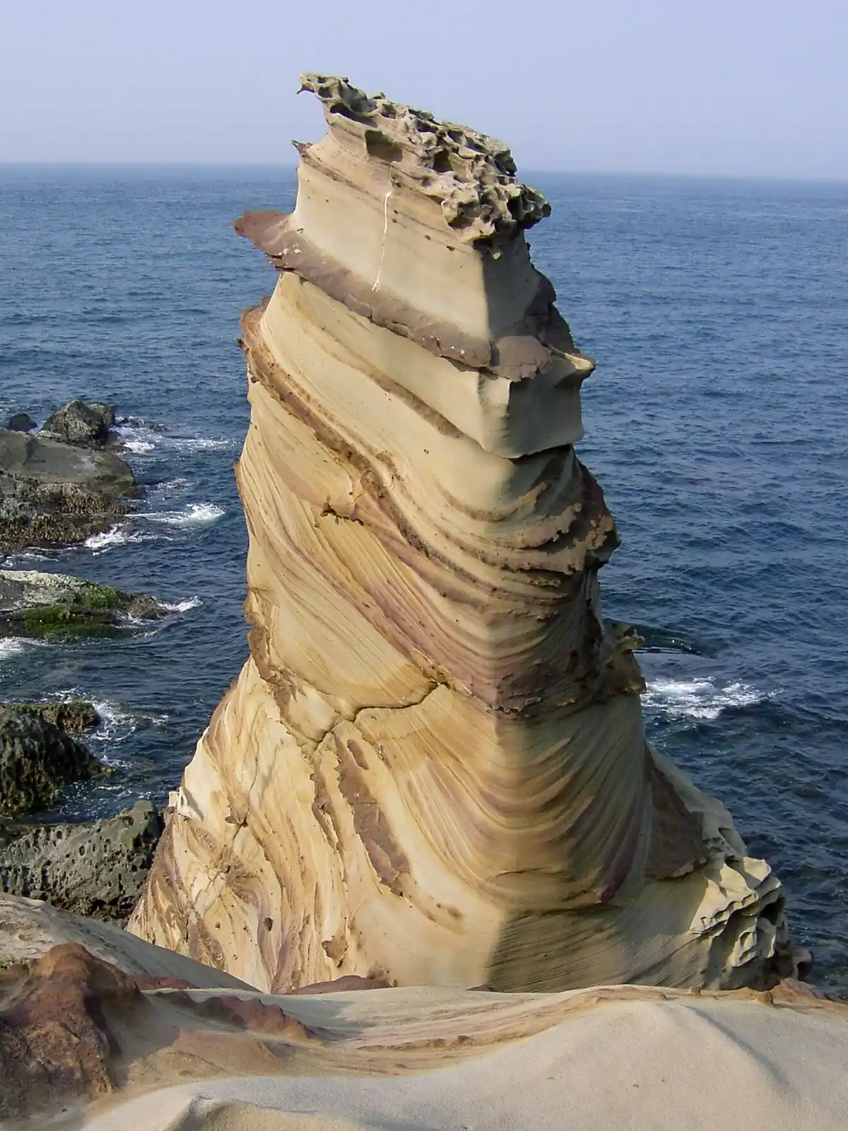
Shen’ao Elephant Trunk Rock & Fanziao Park

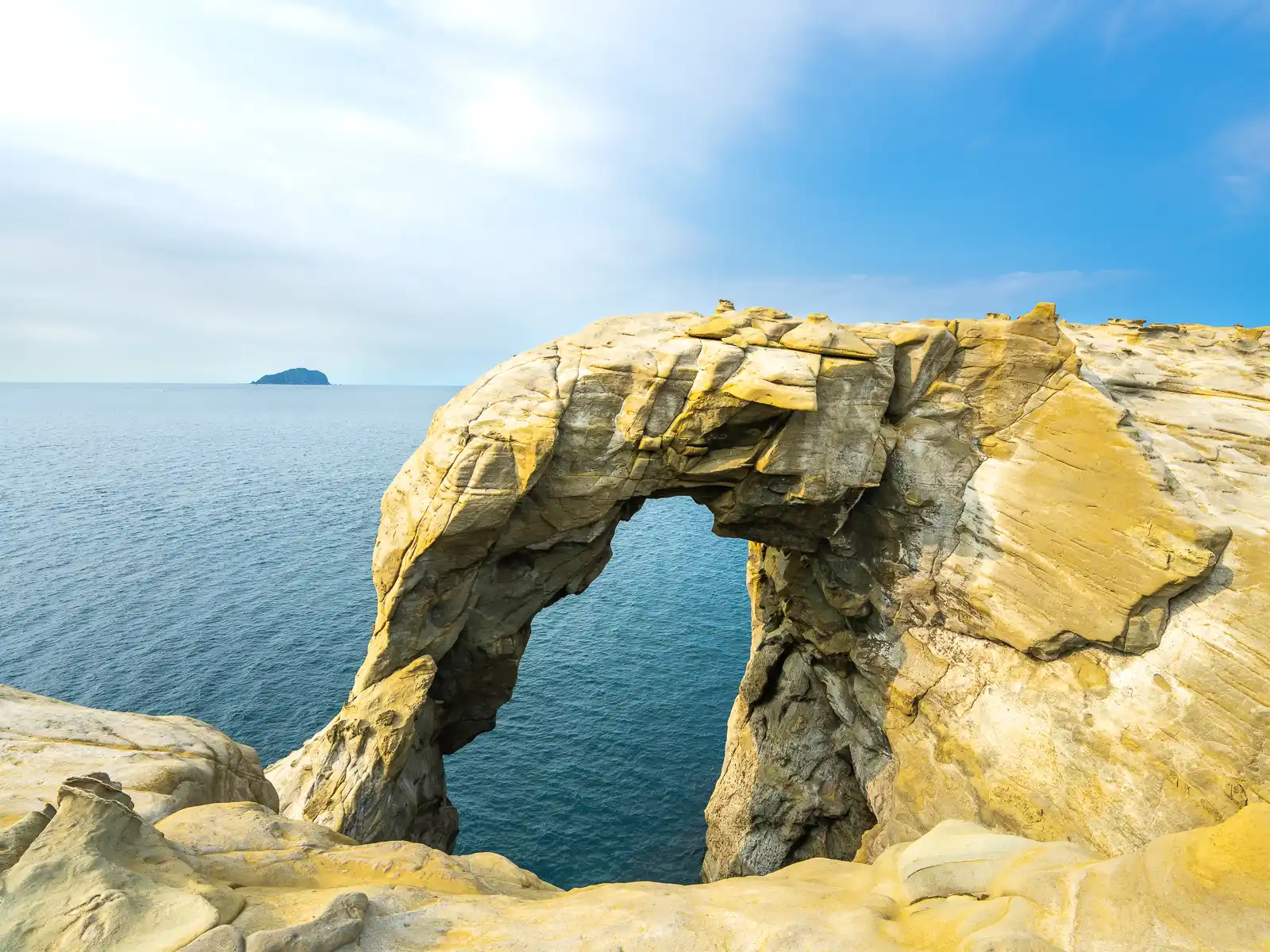

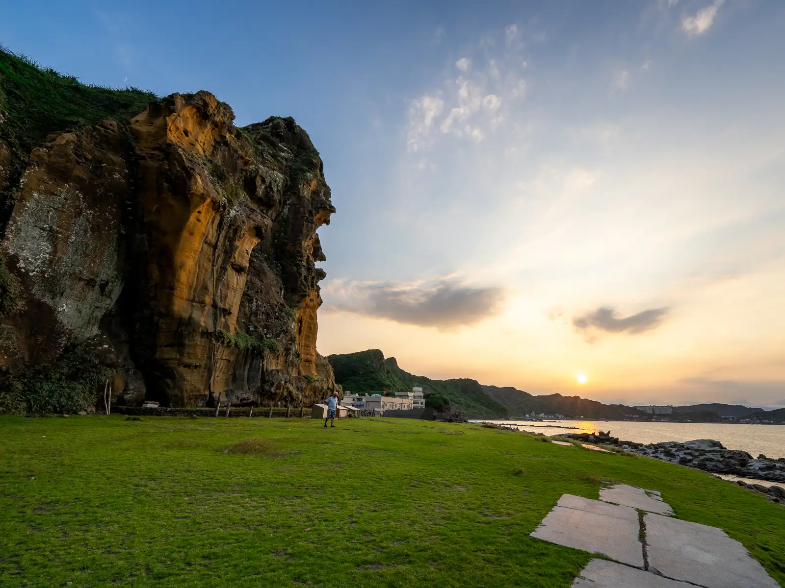
Shen’ao Elephant Trunk Rock lies on the North Coast between the iconic landmarks of Yehliu and Jiufen. Named for its striking resemblance to an elephant’s head, this coastal rock formation offers a dramatic backdrop for sea recreation and paddling.
While access to the top of the rock is restricted for safety reasons, the panoramic view from the adjacent cliff is undeniably breathtaking. Visitors are treated to expansive views of the surrounding landscapes, from the town of Jiufen and Keelung Mountain to the East, to the tranquil Keelung Islet which appears on the horizon.
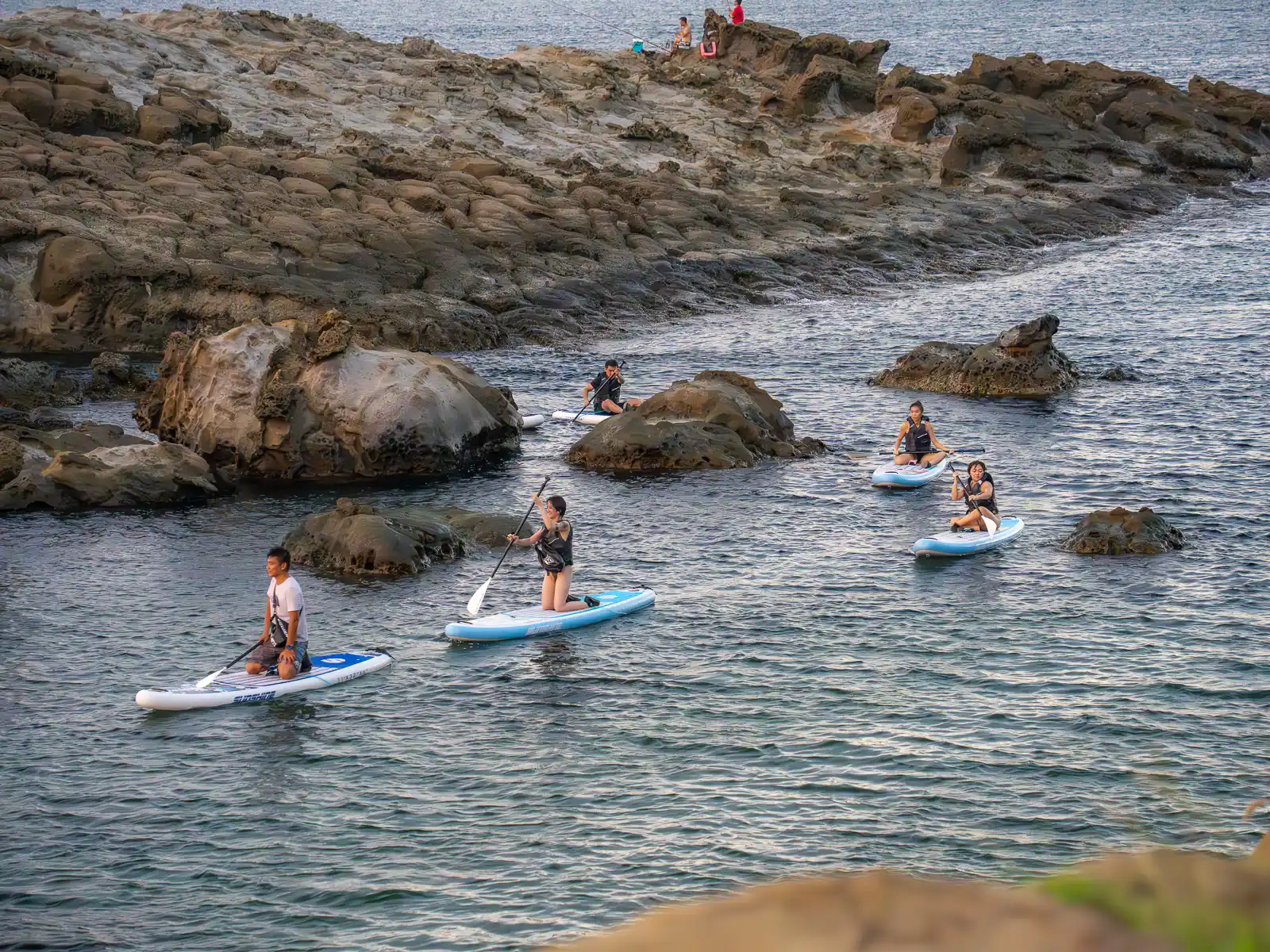
During the summer months, the area transforms into a lively waterpark, bustling with kayakers, stand-up paddleboarders, and swimmers, all sharing and enjoying the waters beneath the rock’s arch.
A couple hundred meters down from Elephant Trunk Rock, Fanziao Park offers another perspective of these seaside sandstone cliffs and formidable sunset views. The park, which can be accessed by returning to the parking lot and walking along the left side of the Elephant Trunk Rock landform, is essentially a large flat grassy area between towering cliffs and an open water swimming area protected by offshore rocks. It’s possible to climb down here for a swim—be warned, during the summer it can get a little crowded.
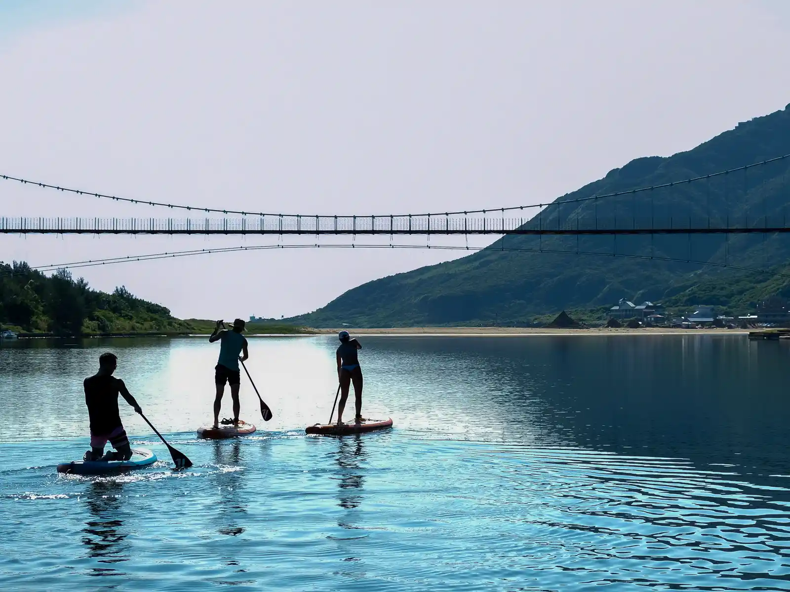
Stand-up Paddleboarding (SUP)
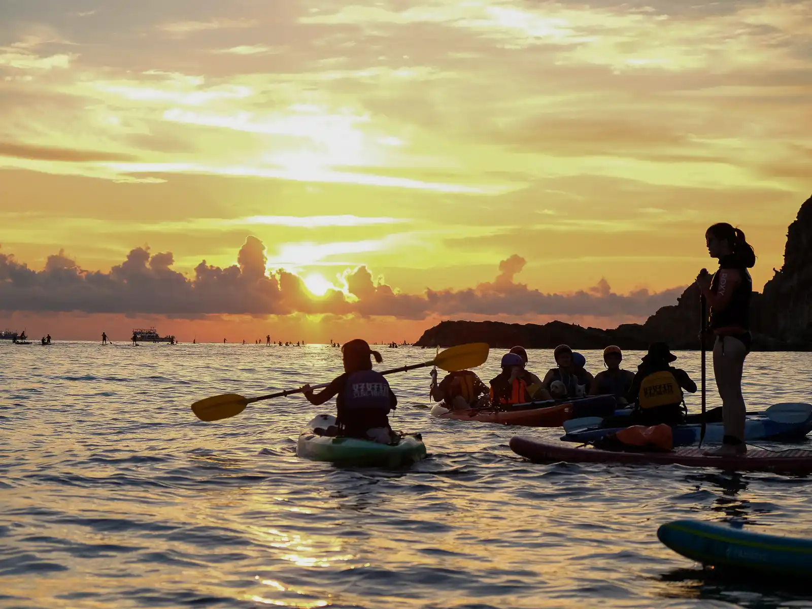
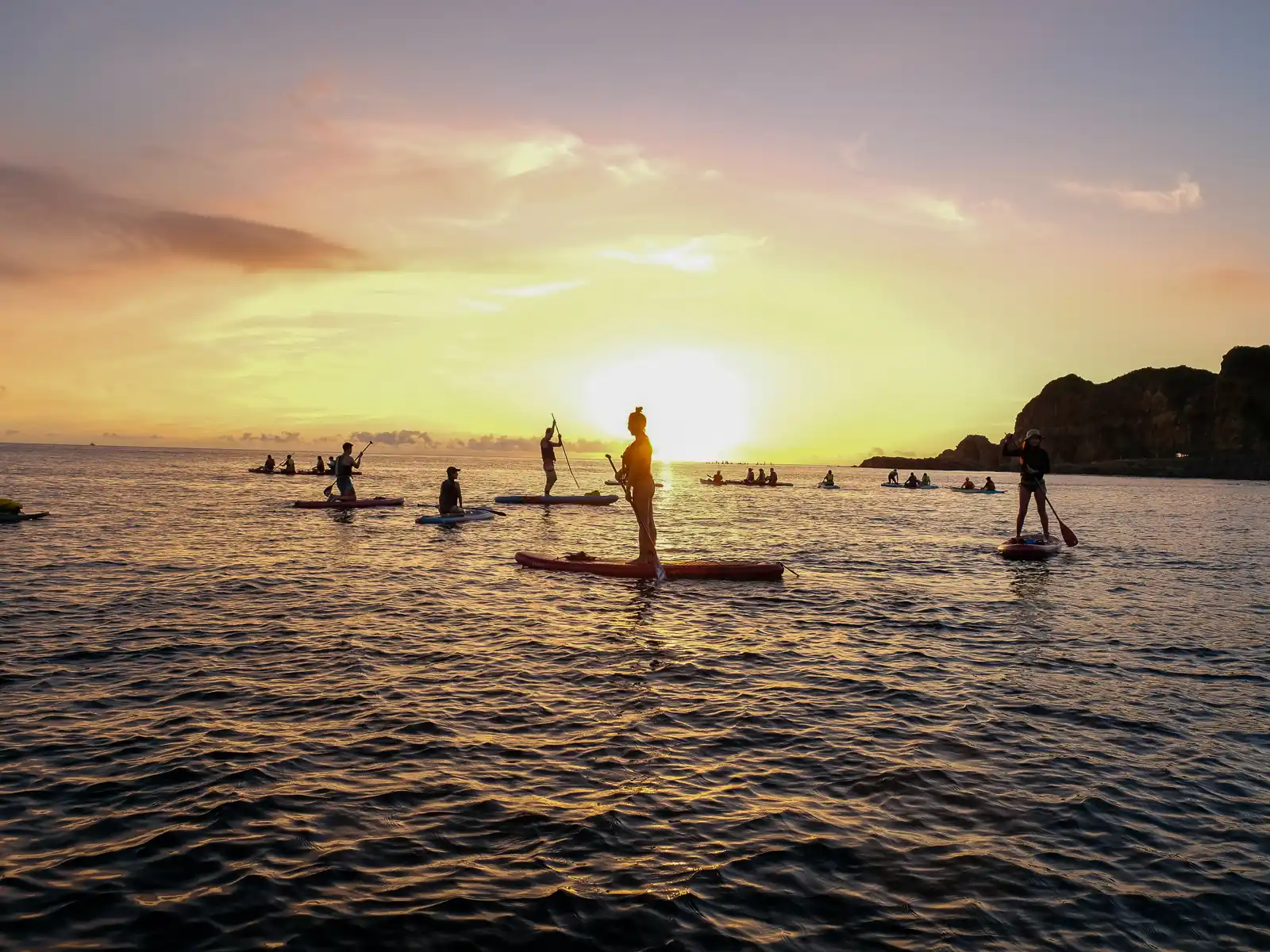
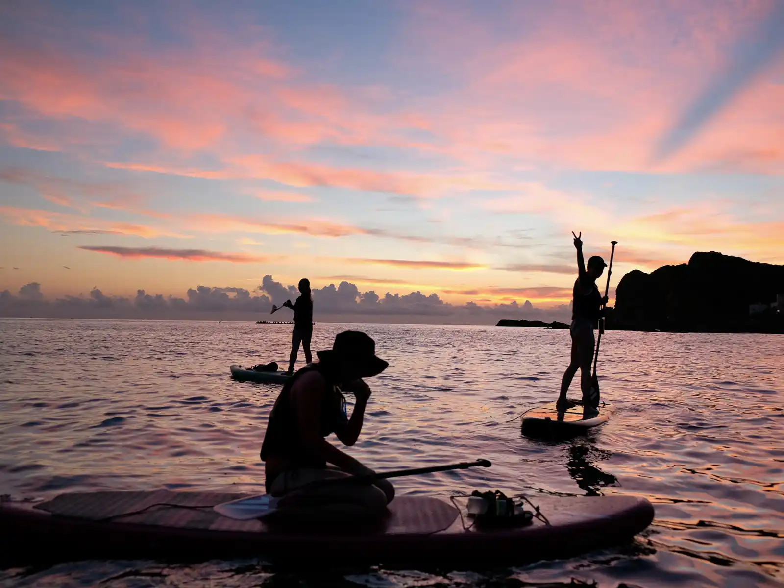
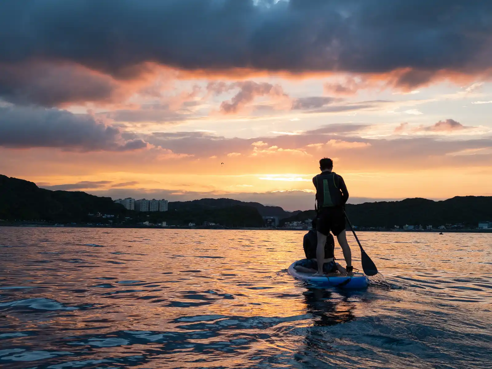
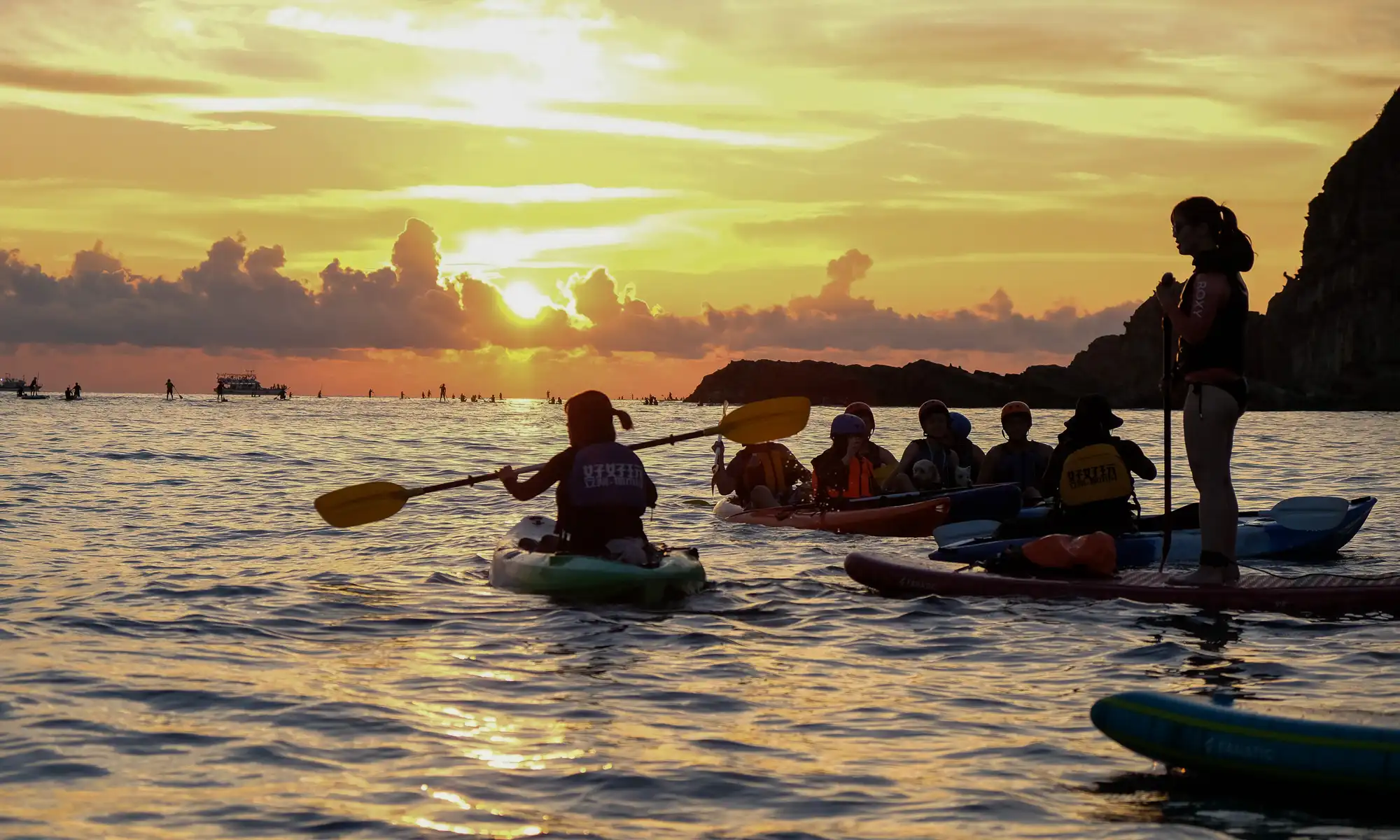
The coastal rock formations of the North Coast are best appreciated from the water. In recent years, two popular destinations have emerged as “must-visit” destinations for Instagrammers, and have resulted in countless sold-out paddling tours. During the summer when the waters are calmer, Elephant Trunk Rock and the Dragon Caves of Longdong are both hotspots for ocean touring, and are often packed with paddleboarders and kayakers, looking to experience the rock formations from another perspective.
Between June and October, tours commonly depart before sunrise and in the late afternoon to both avoid the midday heat and offer guests the best “golden” light for their selfies. Some of the more expensive tours also offer professional portrait and drone photo services.
Duration usually ranges between two to three hours and can include optional open water snorkeling experiences, where it’s possible to swim with puffer fish, countless other species of subtropical fish, and, if you’re lucky, the occasional sea turtle!
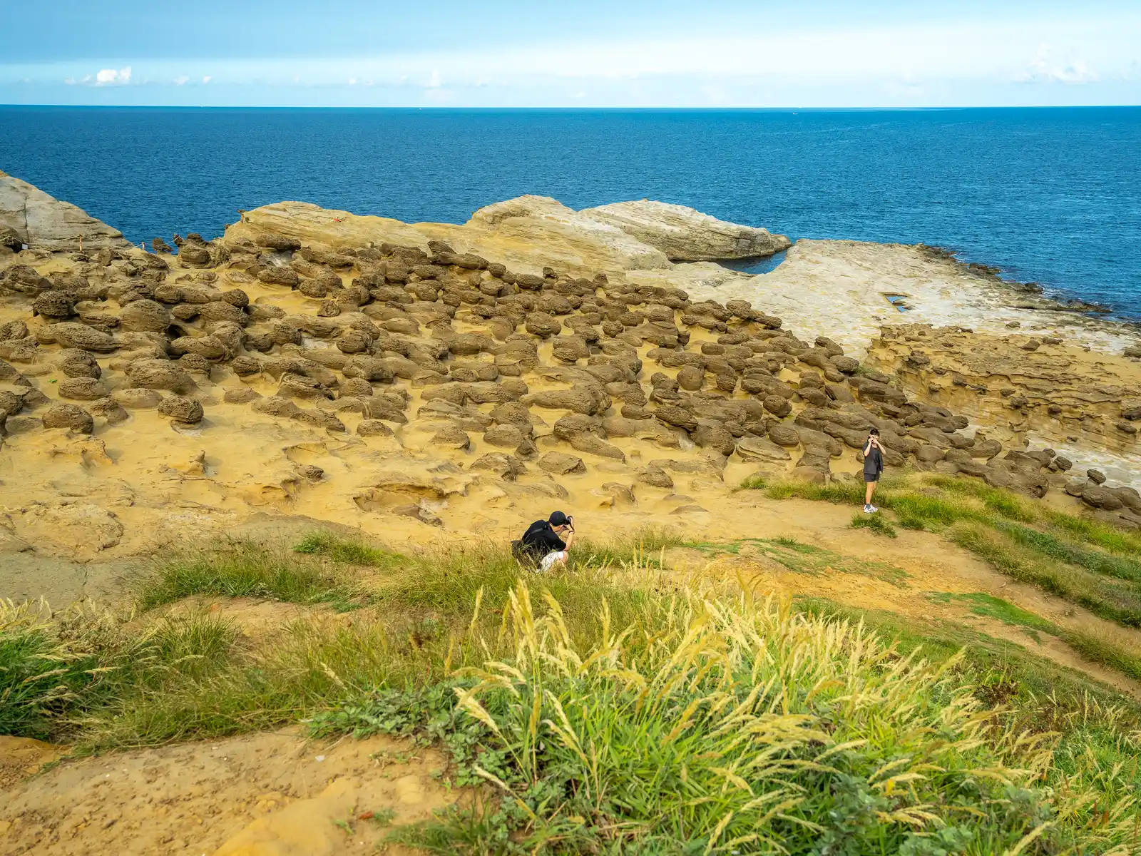
Nanya Geological Hiking Trail & Nanya Rock
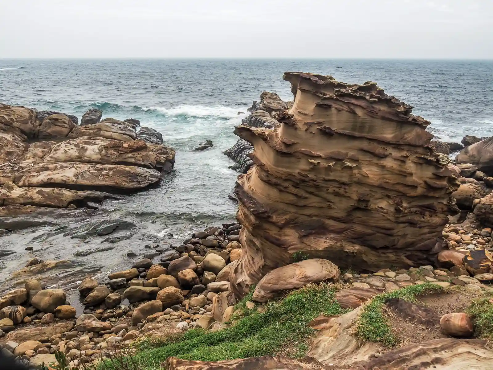
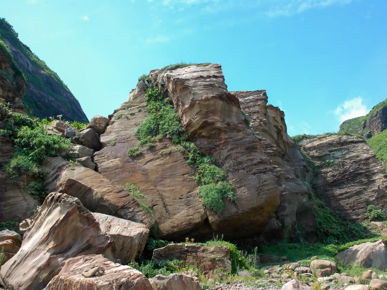
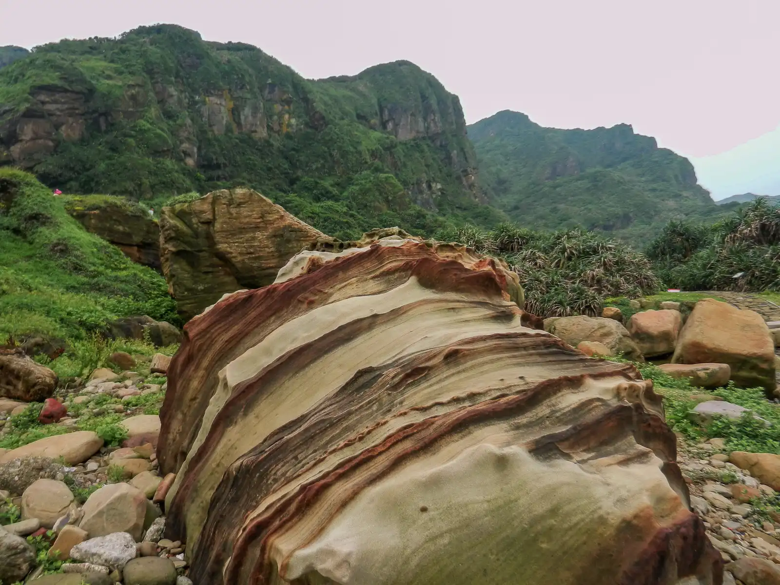
Nanya Geological Hiking Trail (leading to Nanya Rock), is another easy sightseeing destination along a picturesque stretch of cliffs and coastal bluffs on the North Coast near Jiufen. This 300-meter-long trail takes visitors below the coastal highway along a diverse landscape of carved sandstone ledges and eroded rocks. Due to variance in thickness and hardness of the rocks here, the rocks created by erosion have unique flowing patterns. Closer to the shoreline, a vibrant coral reef can be seen.
The beautifully colored main attraction, Nanya Rock, awaits at the end of the trail. The rock’s stripped pattern is the result of the oxidation of iron ore that has been exposed through erosion. Both Nanya Rock and the other landscapes along the trail are particularly beautiful around sunrise and sunset, and are popular destinations for photographers, sightseers and Instagrammers.
Golden Waterfall

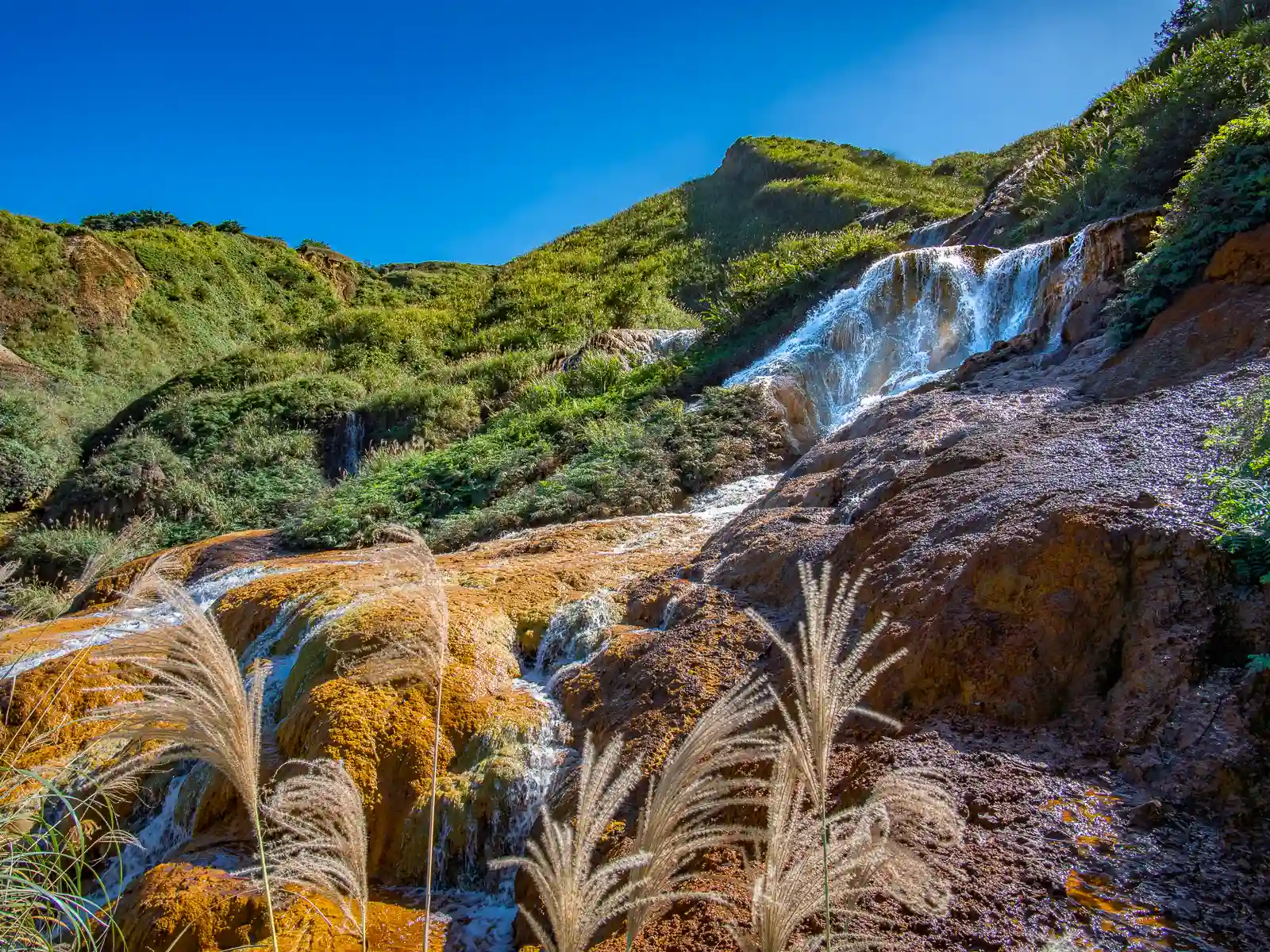
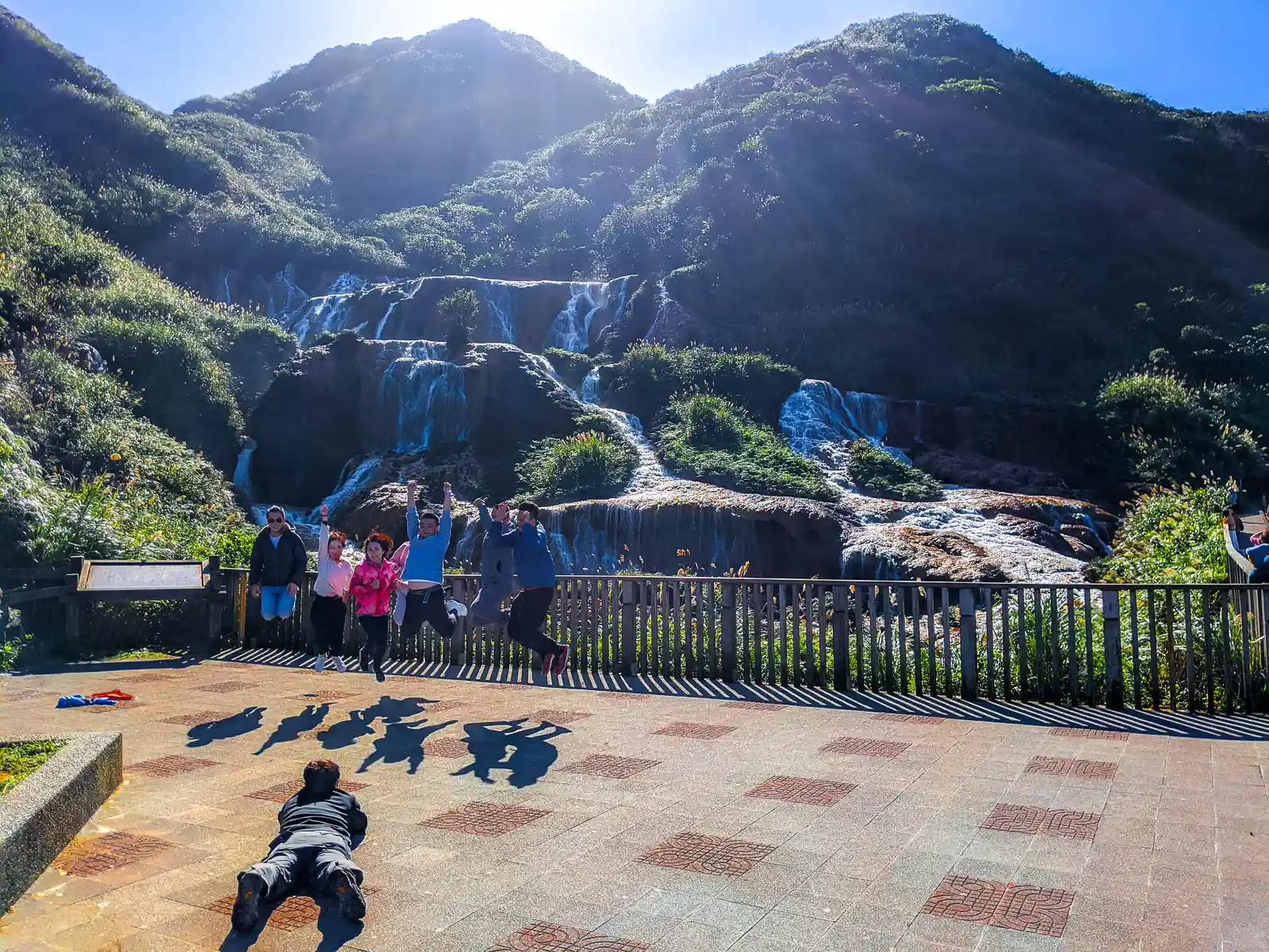
Located halfway down Jinguashi Mountain “behind” Jiufen, the Golden Waterfall is a unique cascade that appears to glow with a unique yellow color. This is due to the high mineral content of the water, which flows down from the mountain above and includes sulfur, arsenic and copper ore. Park at the Golden Waterfall Parking Lot, and cross the street to enjoy this serene and quiet waterfall. Also, make note of the towering cliffs of the eastern side of Keelung Mountain that rise up menacingly behind you!
Remains of the 13 Levels
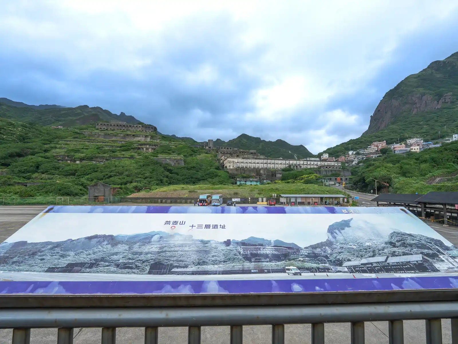
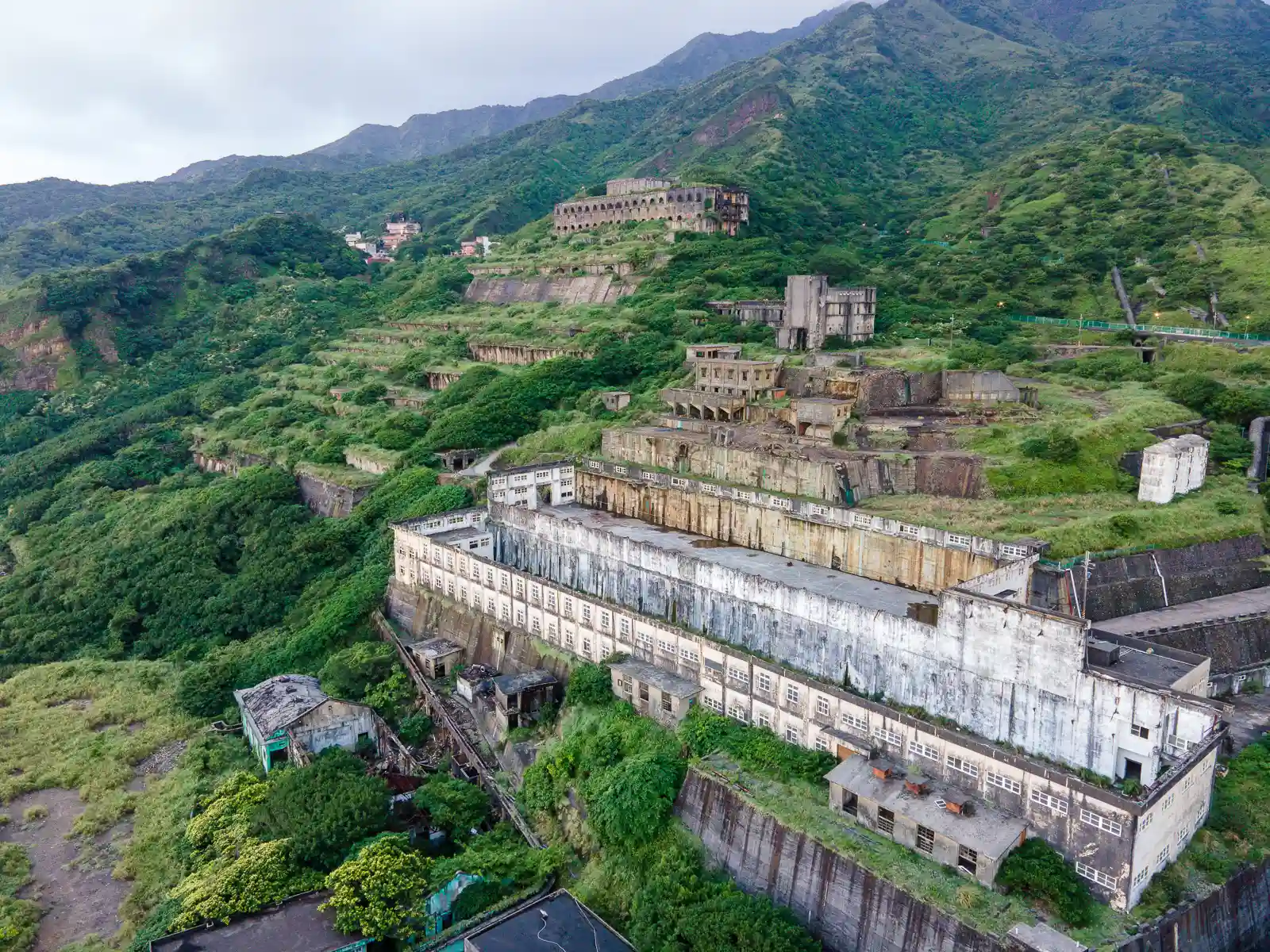
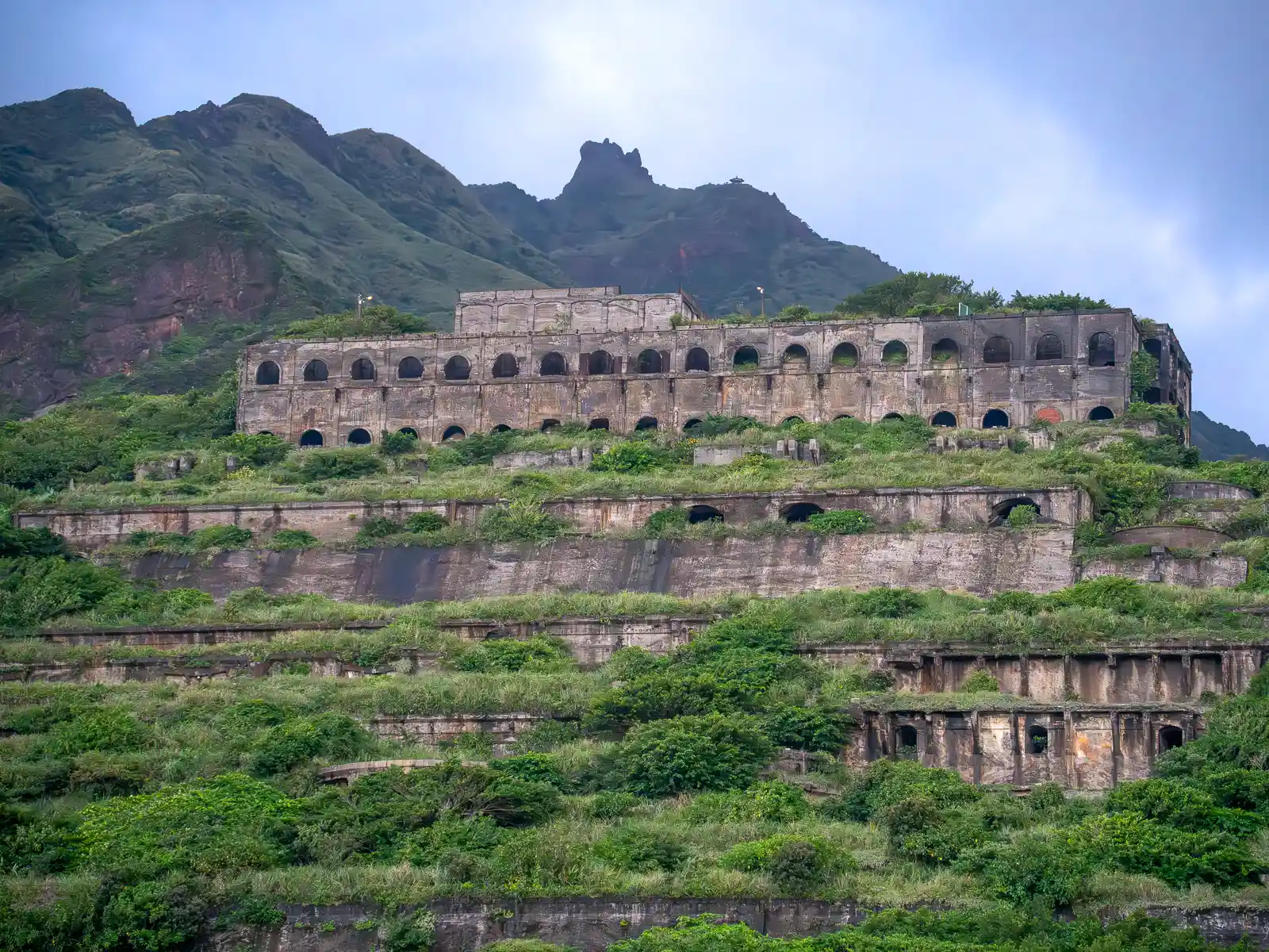
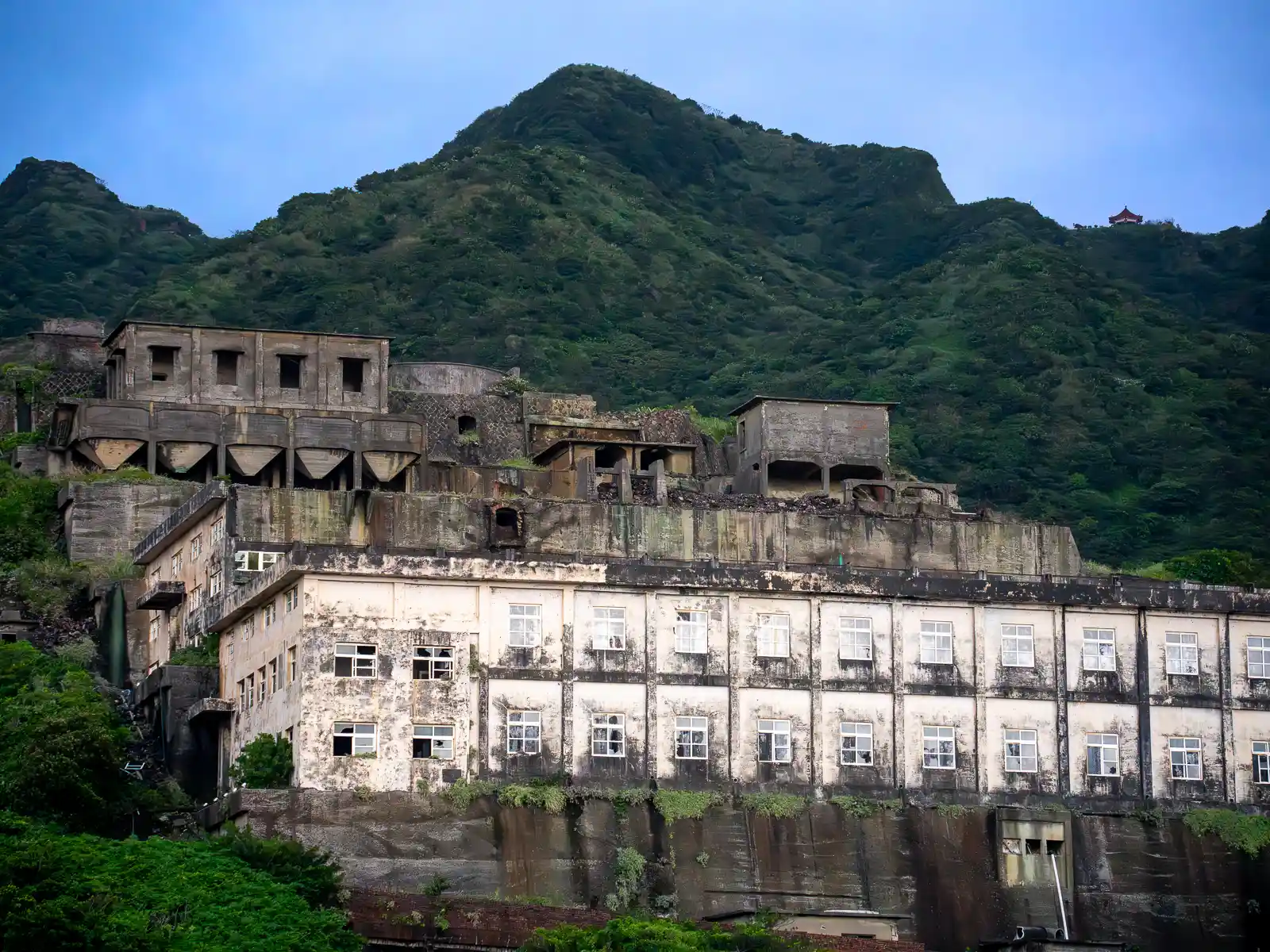
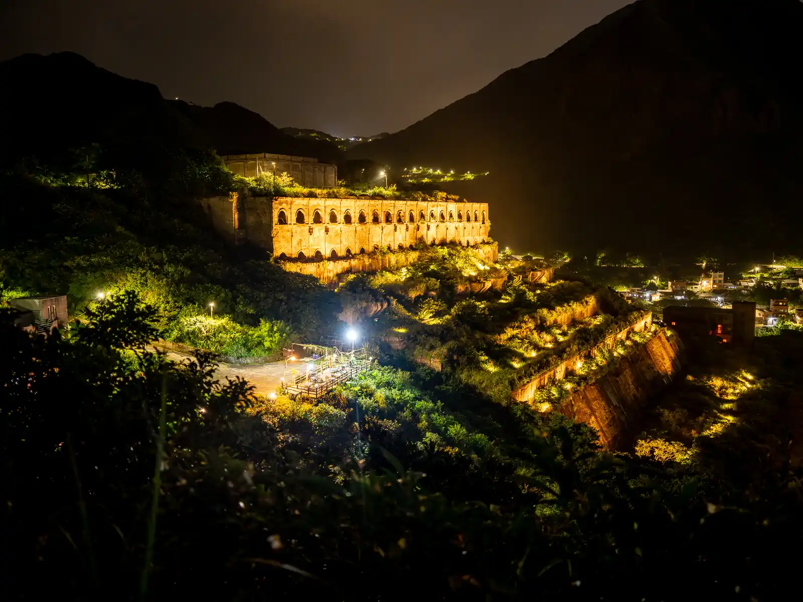
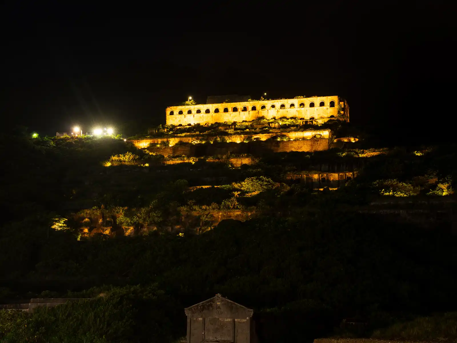
The Remains of the 13 Levels, also called the Potala Palace, of Mountain Mines, refers to the haunting yet photogenic remains of what was once the largest copper and gold smelter in Asia.
Built by the Japanese in 1933, the Shuinandong Smelter processed gold and copper from the mines of Jiufen and Jinguashi for 40 years. It continued its operation until the mines were exhausted, and the industry dwindled. The architecture of the smelter has now been partially reclaimed by nature, which has resulted in a landscape filled with mystery and atmosphere.
On a somber note, the smelter also served as a prisoner of war camp run by the Japanese Empire during World War 2. Both the Remains of the 13 Levels and the surrounding mining infrastructure have been listed as a potential world heritage site.
The scenery of the Remains of the 13 Levels can be conveniently appreciated from the Shui Nan Dong Parking, which is right off the Northern Coastal Highway. Alternatively, the Changren Gazebo offers a closer view of the former smelter against the background of Keelung Mountain.
Teapot Mountain Trail & Baoshi Mountain Lookout
The Teapot Mountain Trail is a moderate-difficulty, half-day hike that offers panoramic views, relaxing gazebos and an exciting finish. Entrances are located behind the New Taipei City Government Gold Museum and at the nearby Quanji Temple Parking Lot.
Starting from the Gold Museum, the trail begins with several sets of steep stairs as it quickly ascends the mountainside behind Jinguashi. Setting out from the Quanji Temple Parking Lot, on the other hand, offers a slightly more gradual ascent. Regardless of which entrance you choose, the two paths converge at the Chaobao Pavilion.
During this initial section, enjoy occasional views of the cone-shaped Keelung Mountain behind you and the Yinyang Sea below. Numerous pavilions along the way provide relaxing spots to rest.
The adventure truly begins once the hike reaches the spine of Teapot Mountain. The subsequent section involves scrambling up the ridgeline with the assistance of fixed ropes, navigating precipices, and even passing through a small cave! This route has been described as both “scary” and “challenging”, but once at the top, it offers one of the most rewarding views in all of Ruifang and the North Coast!
Insider’s Tip – Baoshi Mountain Trail: If you’re looking for 360-degree views without the physical challenges of the Teapot Mountain Trail, consider the adjacent Baoshi Mountain Trail—known as the shortest trail in Taiwan offering panoramic ocean views. The trail entrance can be accessed from the Quanji Temple Parking Lot. Follow the walkway for a short 160 meters to reach the Baoshi Mountain Lookout, a circular viewing platform, which boasts views that rival those from Teapot Mountain above.
For weather forecasts and additional information, visit the New Taipei Travel website.
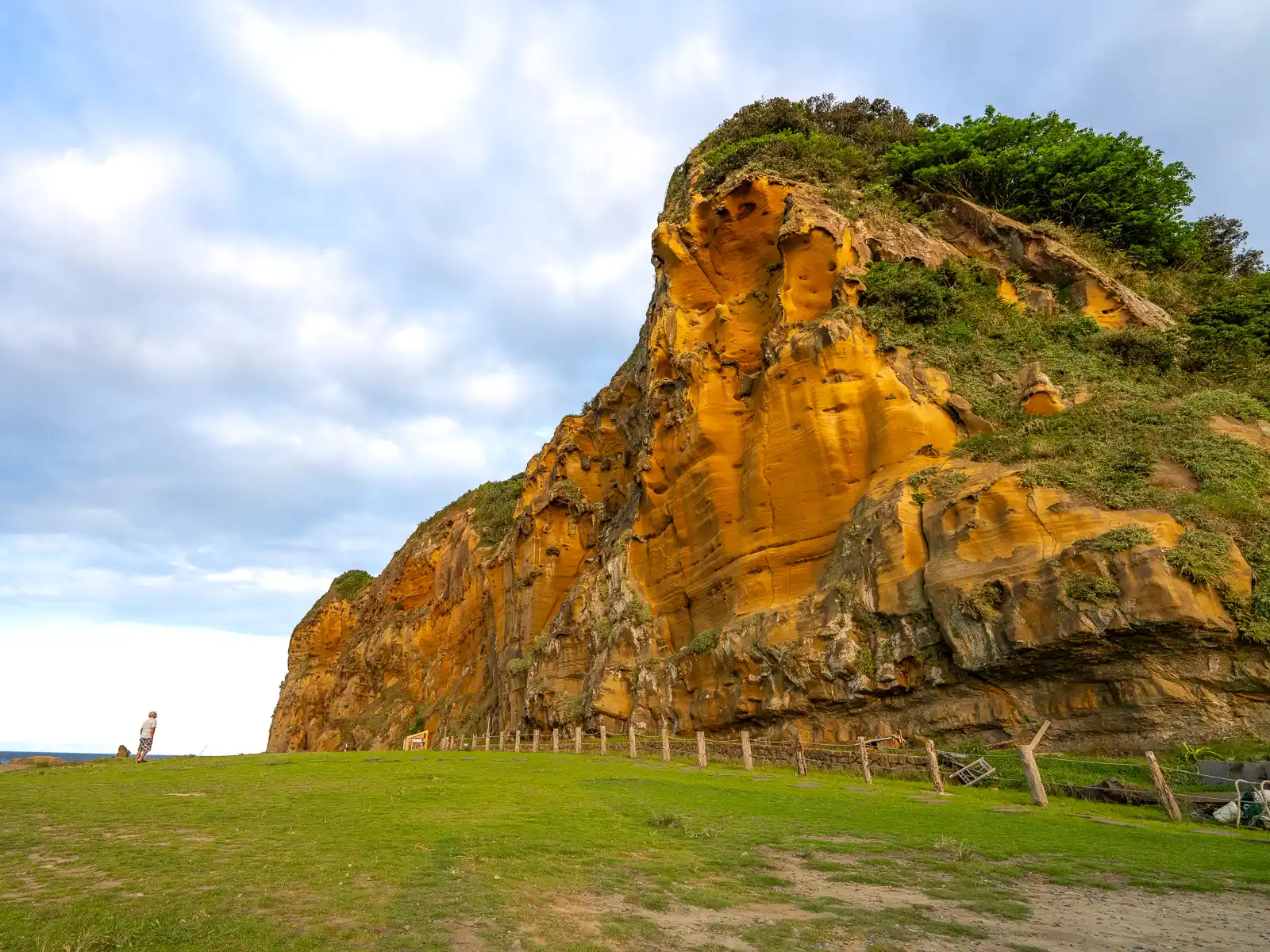
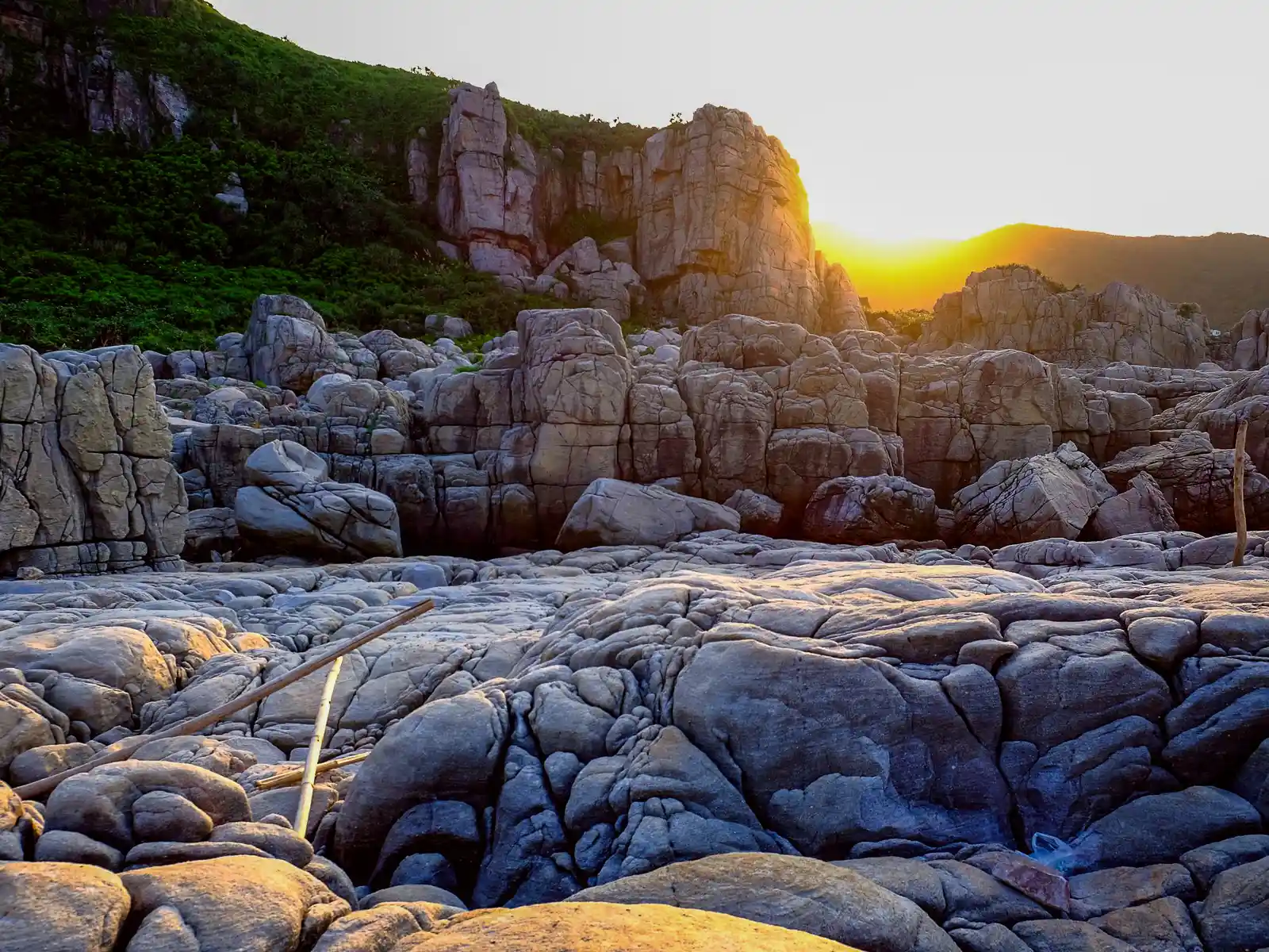
Bitoujiao Scenic Area
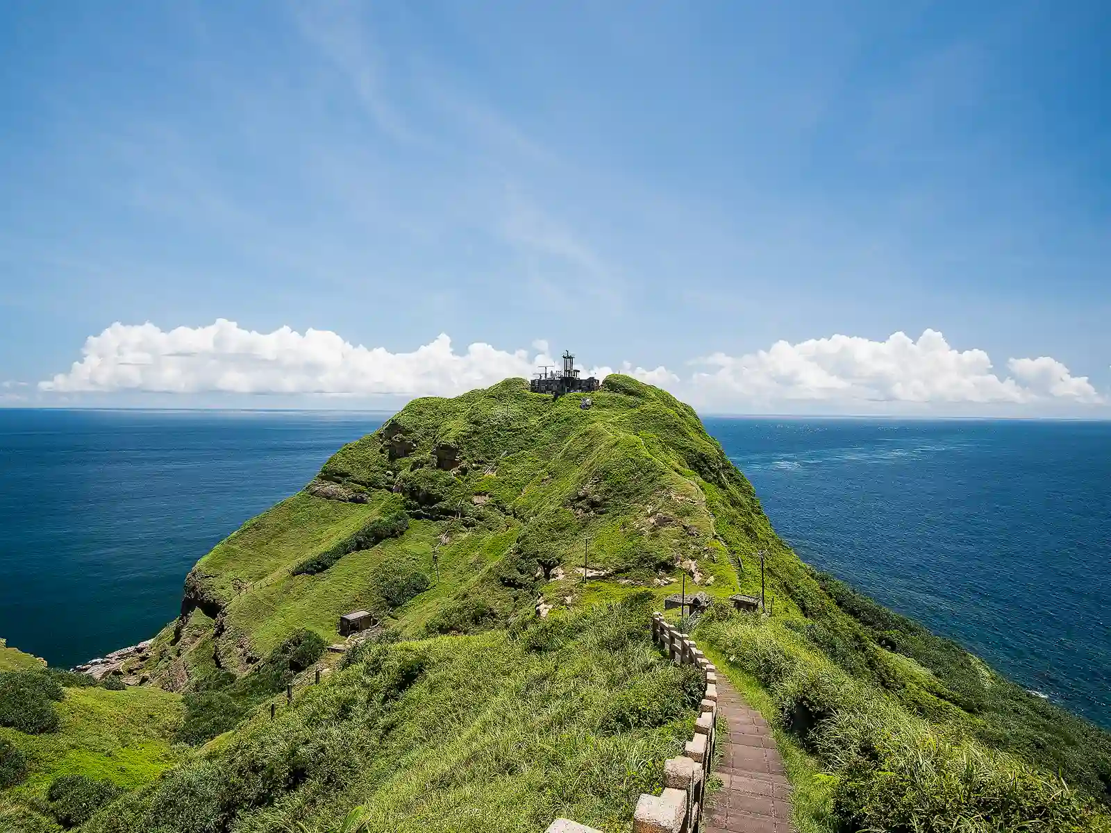
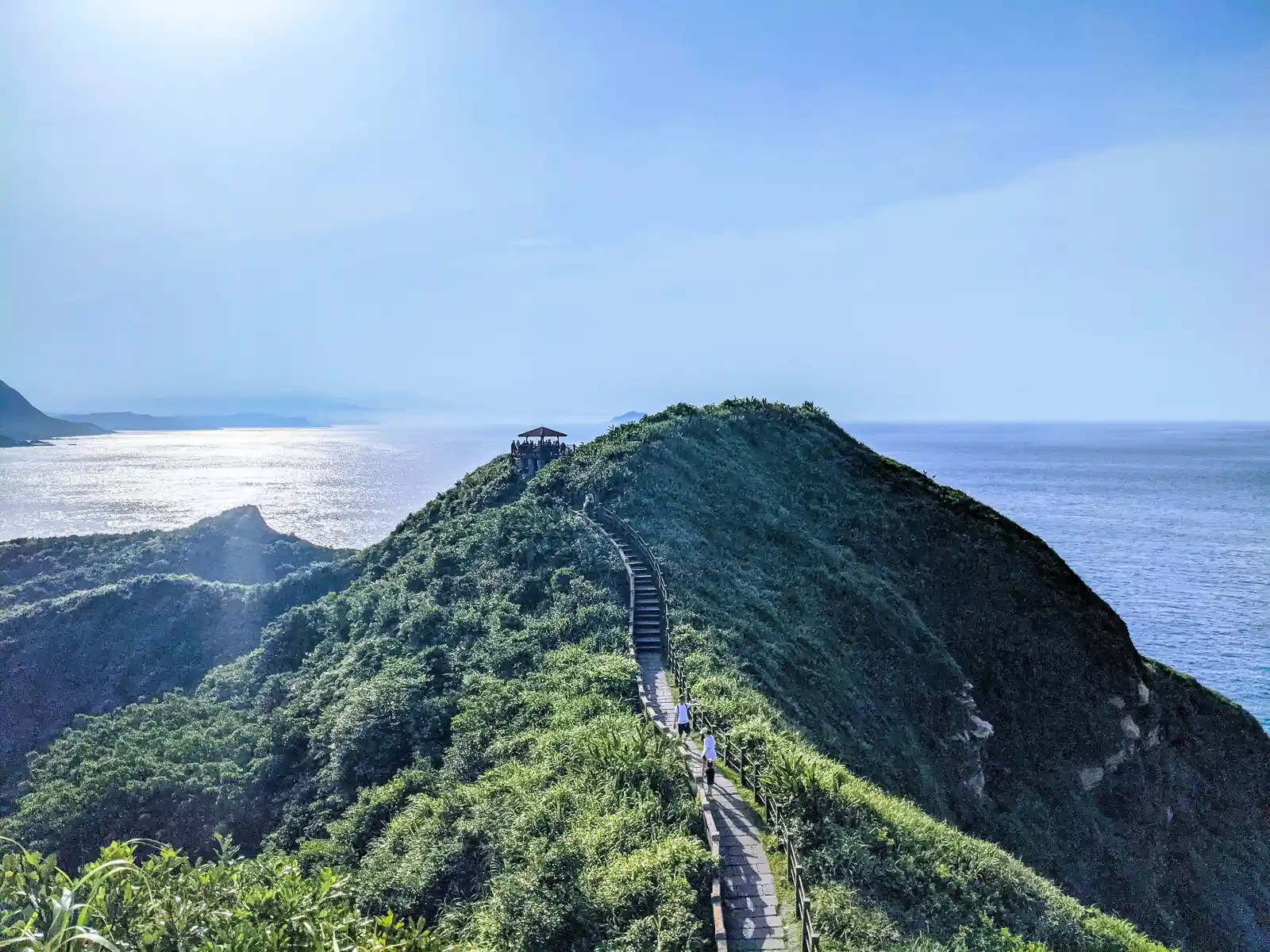
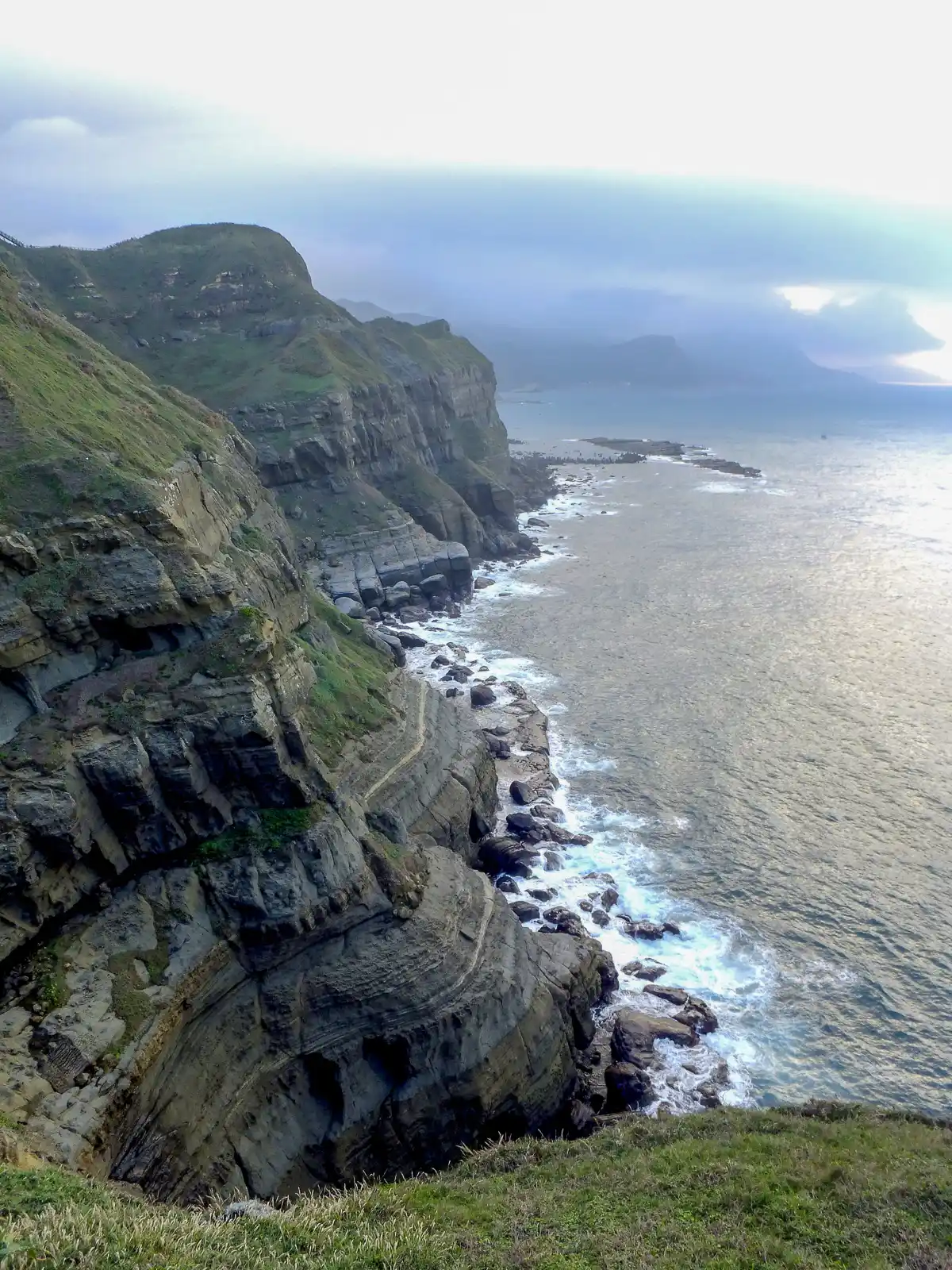
The Bitoujiao Valley Trail, known locally as the “Taiwanese Great Wall”, is an approximately 2-kilometer-long loop hike that scales the rocky bluffs of Bitou Cape, offering expansive views in both directions along the coast. The hike gets its nickname from its resemblance to the Great Wall of China, as it follows along coastal ridges. Along the way, several pavilions at regular intervals along the hike offer places to rest and shelter from the sun or elements.
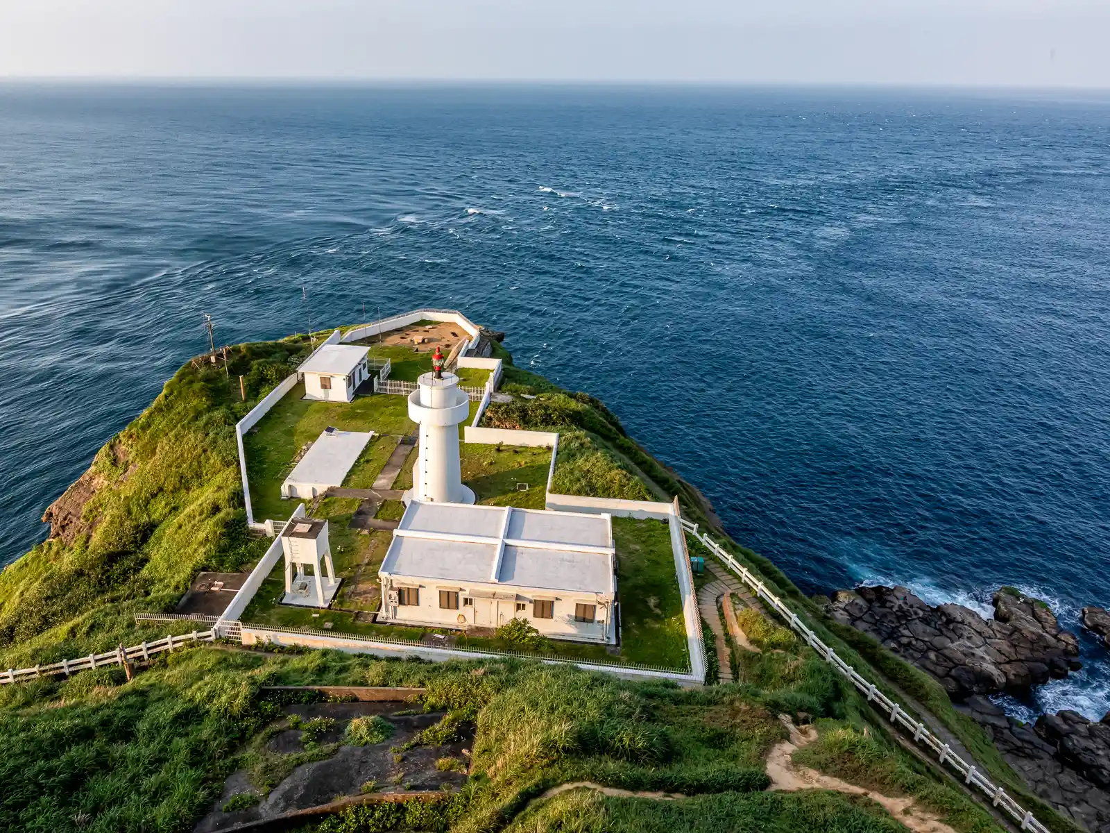
As the path to the lighthouse on the northernmost point of the cape is temporarily closed due to erosion, hikers will want to turn around upon reaching the Wave Crashing Camp, a colorful military bunker that has been repurposed into a coffee shop. But, not before grabbing a coffee, cooling off, and appreciating the unique vantage point of the North Coast from the ridgeline.
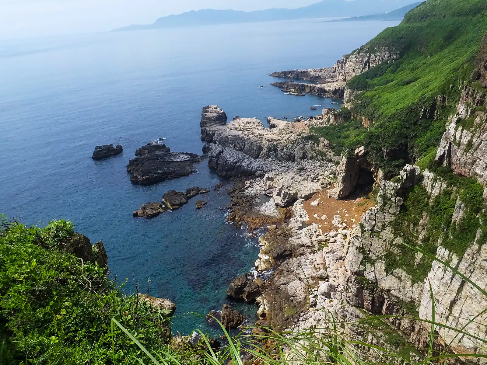
Water Recreation in Longdong Bay


Longdong Bay is the largest bay on Taiwan’s Northern Coast, and due to its scenic location and abundant marine life, is a hotspot for water activities. The bay area itself is deep enough that both freediving and scuba classes are held here. Local marine life consists of large numbers of colorful fish and some coral (although there is significantly more coral the closer you get towards the Longdong Caves).
Around a dozen outfitters along the road leading to the public parking area at Hemei Elementary School offer freediving, scuba, stand-up paddle and kayak tours, as well as the option to just rent snorkeling gear. If going without a guide, a semi-protected natural snorkeling area can be found out towards the Longdong Caves by following the seaside path. If the sea is calm, this enclosed area offers some of the best, safest snorkeling and swimming around.
Longdong Climbing Area

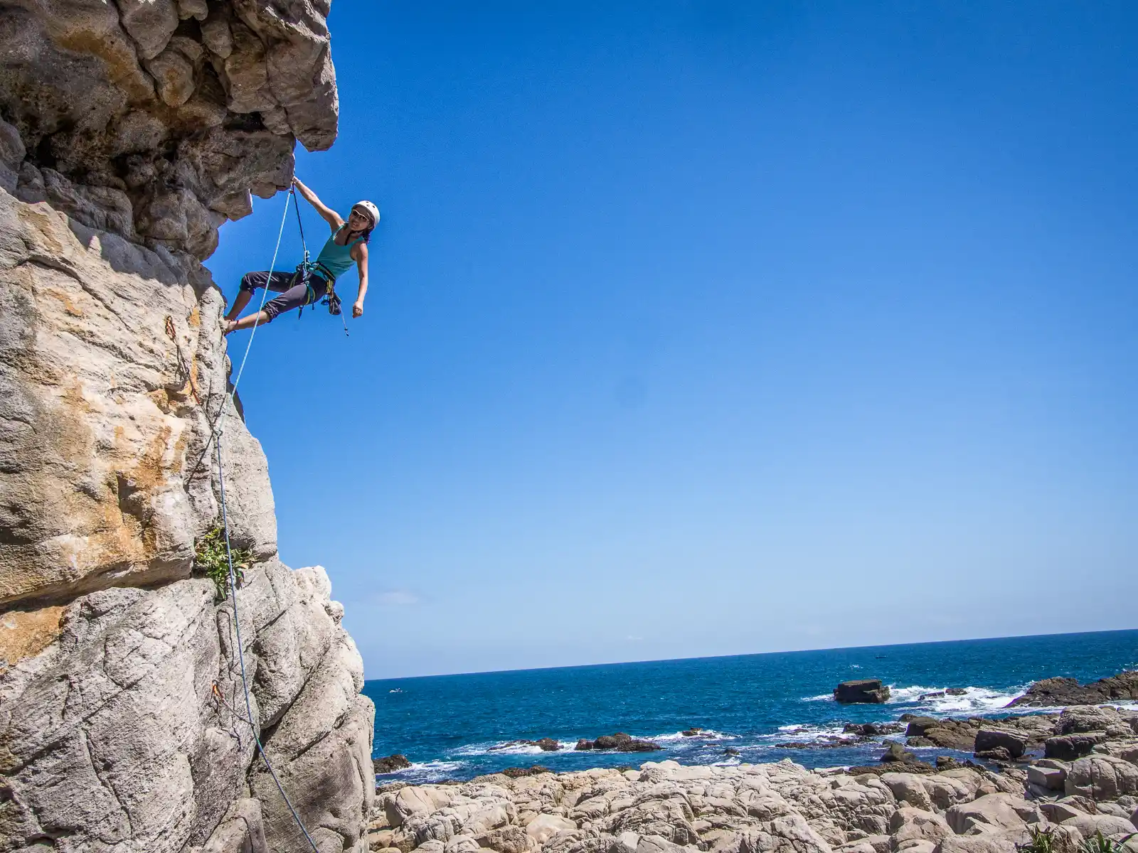
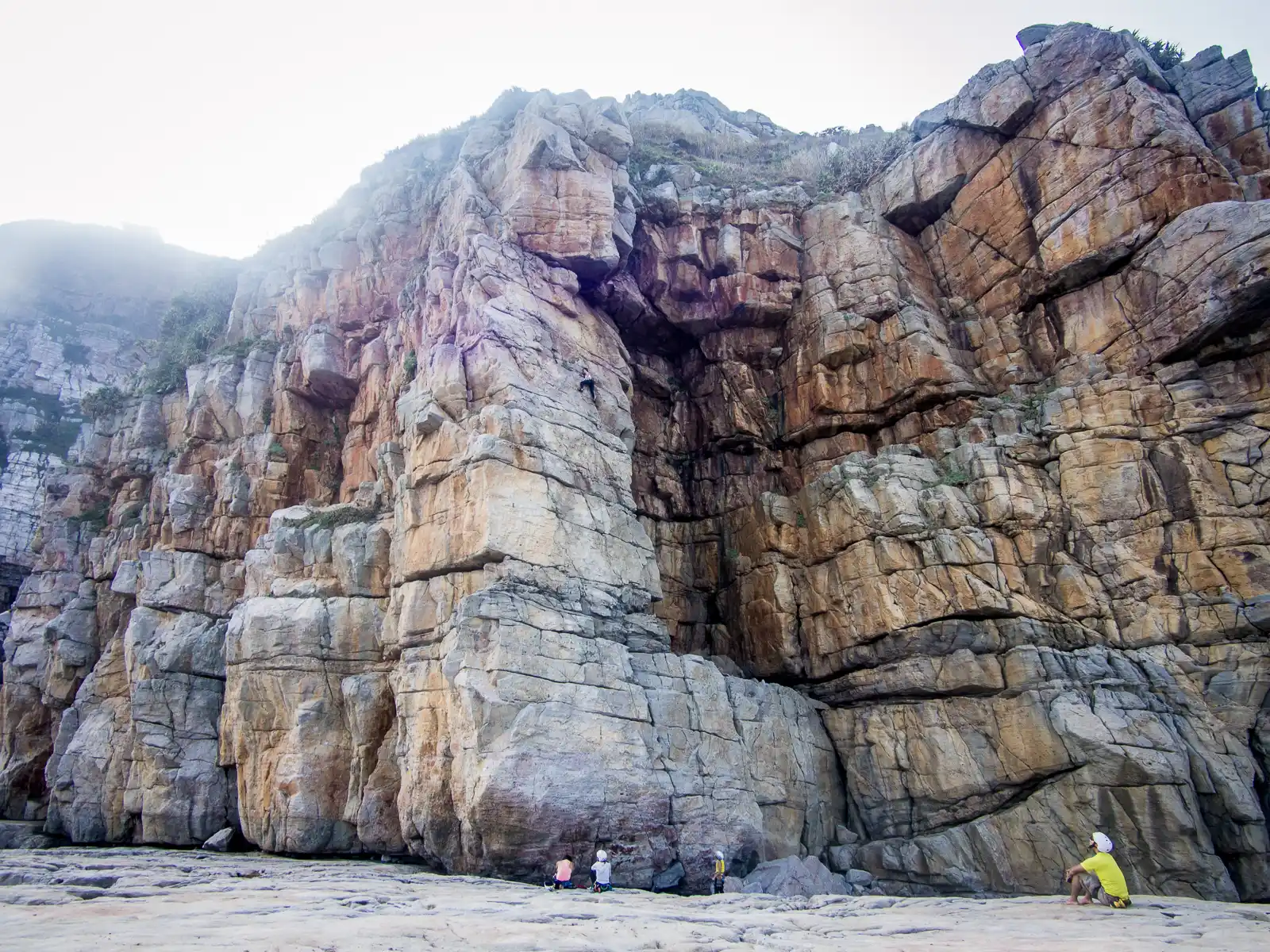
Just around the corner from Longdong Bay, a group of towering seaside cliffs aptly named the “Dragon Caves” (actually, this is a direct translation of “Longdong”) hide a climbing paradise, which is Taiwan’s premiere destination for recreational outdoor climbing.
The cliffs offer dozens of routes for sport and traditional climbers, with options for all skill levels available. Due to the area’s isolated nature of the area, it’s advisable to reserve courses and guides in advance in Taipei, if necessary. The easiest access to the climbing area can be had through a seaside path that leads southeast of the public parking in front of Hemei Elementary School.
Fulong Beach
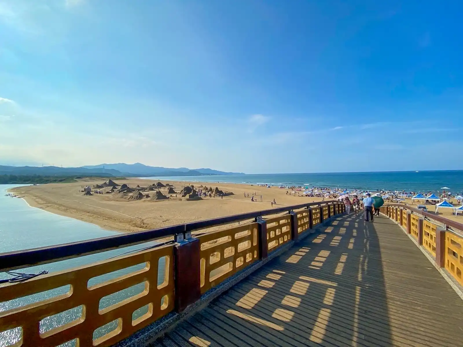
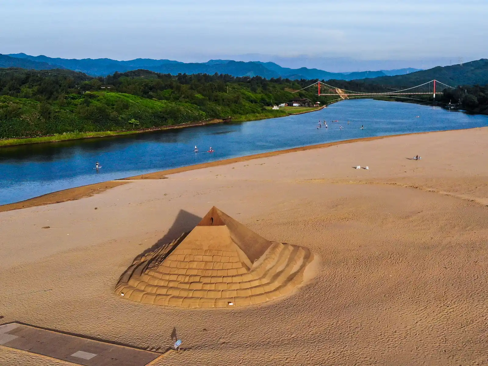

Just another 20 minutes down the coast is Fulong Beach, the North Coast’s premiere white sand beach. This 3-kilometer long coastal paradise has something for everyone including gentle cycling, ocean swimming, paddling tours, kayaking tours, a surfing area, and even a summer-long festival: The Fulong International Sand Sculpture Art Festival.
The tip of Fulong Beach is actually a sandbar that extends out alongside the Shuang River estuary. The estuary, with its calm water, is ideal for paddling tours (kayak and SUP), and is often filled with tour groups paddling several kilometers back to the railroad bridge.
Surfing, on the other hand, is possible on the ocean side of the beach and around the mouth of the river. The Fulong Beach sandbar is also home to The Fulong Sand Sculpture Festival which typically runs from late-May to October.