
Simply put, Taiwan has some of the world’s best hiking trails. With 5 mountain ranges and 268 peaks over 3,000 meters (approx. 10,000 feet)—including the highest peak in Eastern Asia—as well as a well-developed network of mountain roads connecting cities to the Central Mountain Range, there is no shortage of breathtaking day hikes to choose from. From leisurely forest strolls to peak bagging trips, and even multi-day traverses, Taiwan’s mountains offer something for everyone. Taiwan operates 14 National Forest Recreation Areas and 8 National Parks, and, even if you don’t make it to a National Park, chances are that there’s a local hiking trail or waterfall within under an hour’s drive from any location where you might be. This is Taiwan, after all: the world’s most mountainous island. Here are Taiwan’s top 5 hikes.
Sandiaoling Trail in Ruifang District, New Taipei City
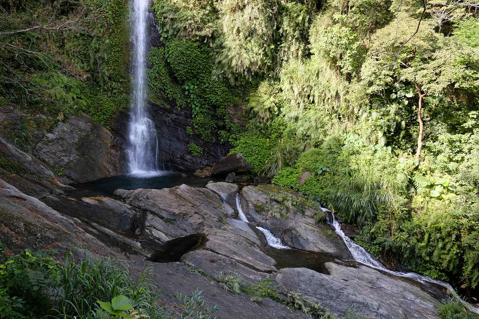
Taipei’s Famous Jungle Trek to Three Enormous Waterfalls
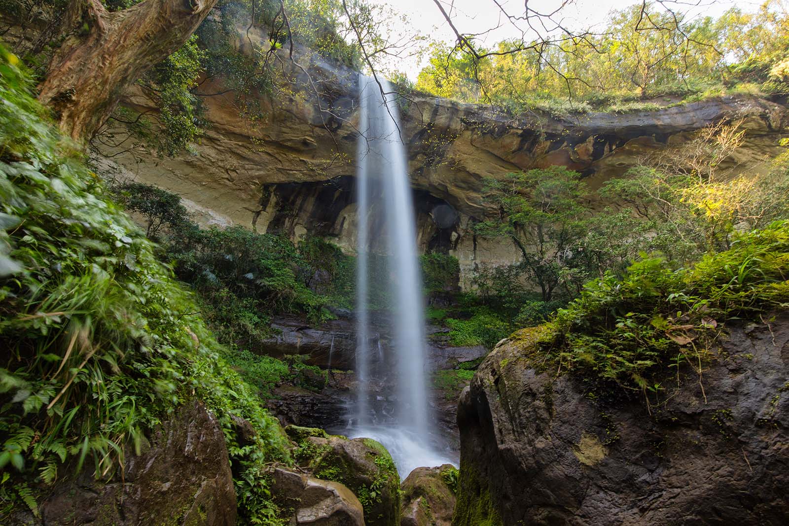
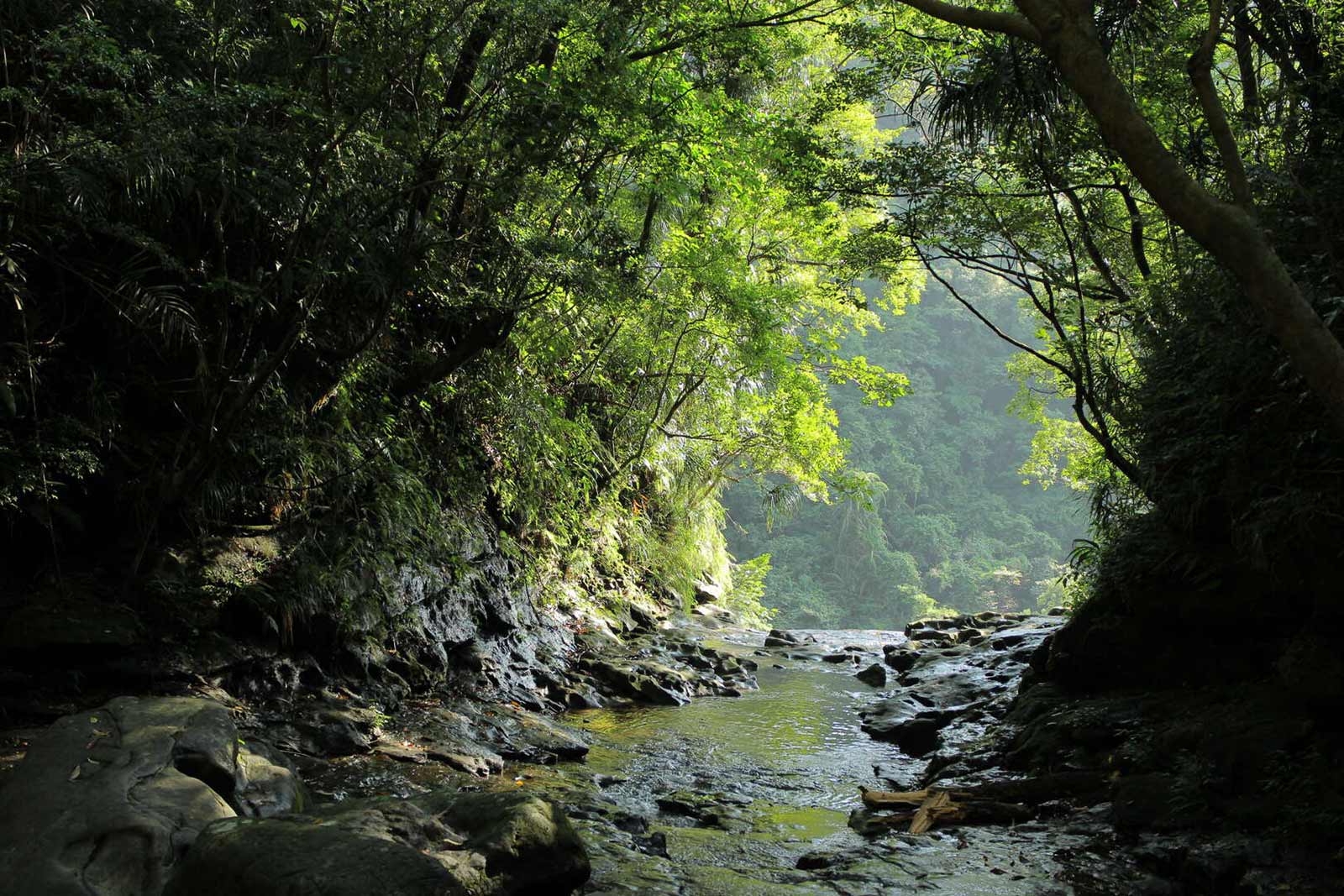
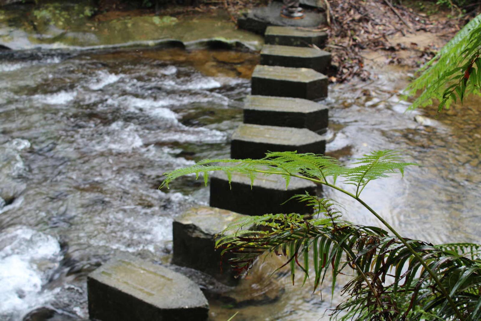
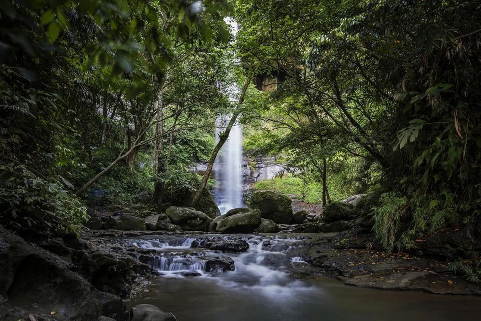
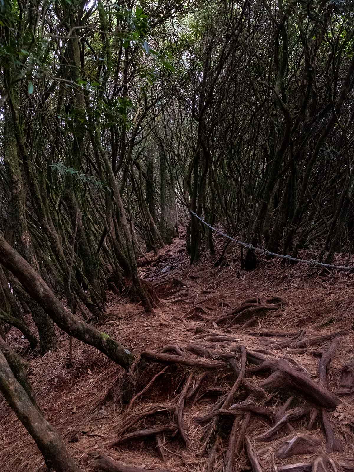
Taipei’s most scenic day hike, the Sandiaoling Waterfall Trail, is an easy-to-moderate hike that follows a tributary of the Keelung River Valley to three 40 meter waterfalls.
The trail starts from the picturesque town of Sandiaoling on the Pingxi Rail Line. After a short jungle climb, the first waterfall comes into view below the trail. After another 30 minutes, the second waterfall, Motien Waterfall—meaning “touching the sky”—emerges in front of you. Here the trail borders the river and it’s possible to cool off before continuing further. The Sandiaoling Trail then continues climbing above Motien Waterfall and eventually reaches the third stunning cascade, Pipa Waterfall.
The 7-kilometer trek takes anywhere between 3-7 hours depending on physical condition. Highly rewarding jungle scenery and magnificent overhanging waterfalls make the effort worthwhile.
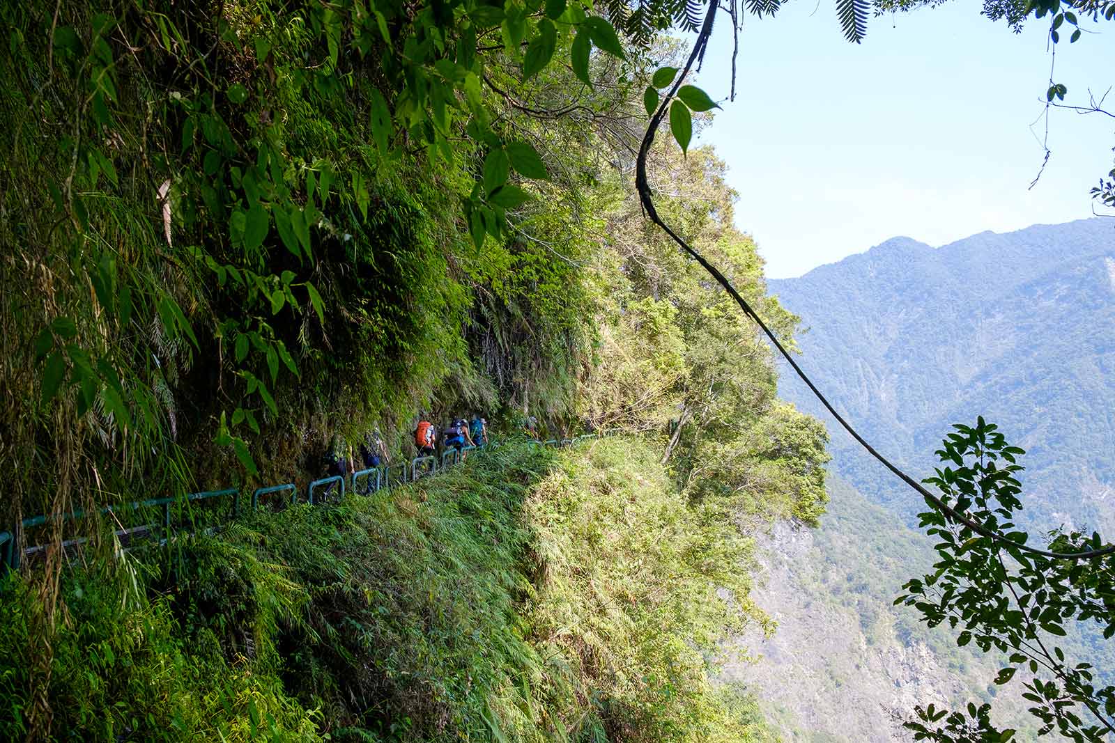
Zhuilu Old Trail (Taroko National Park) in Xiulin Township, Hualien County
The Best View in Taroko—From a 500-Meter Cliff

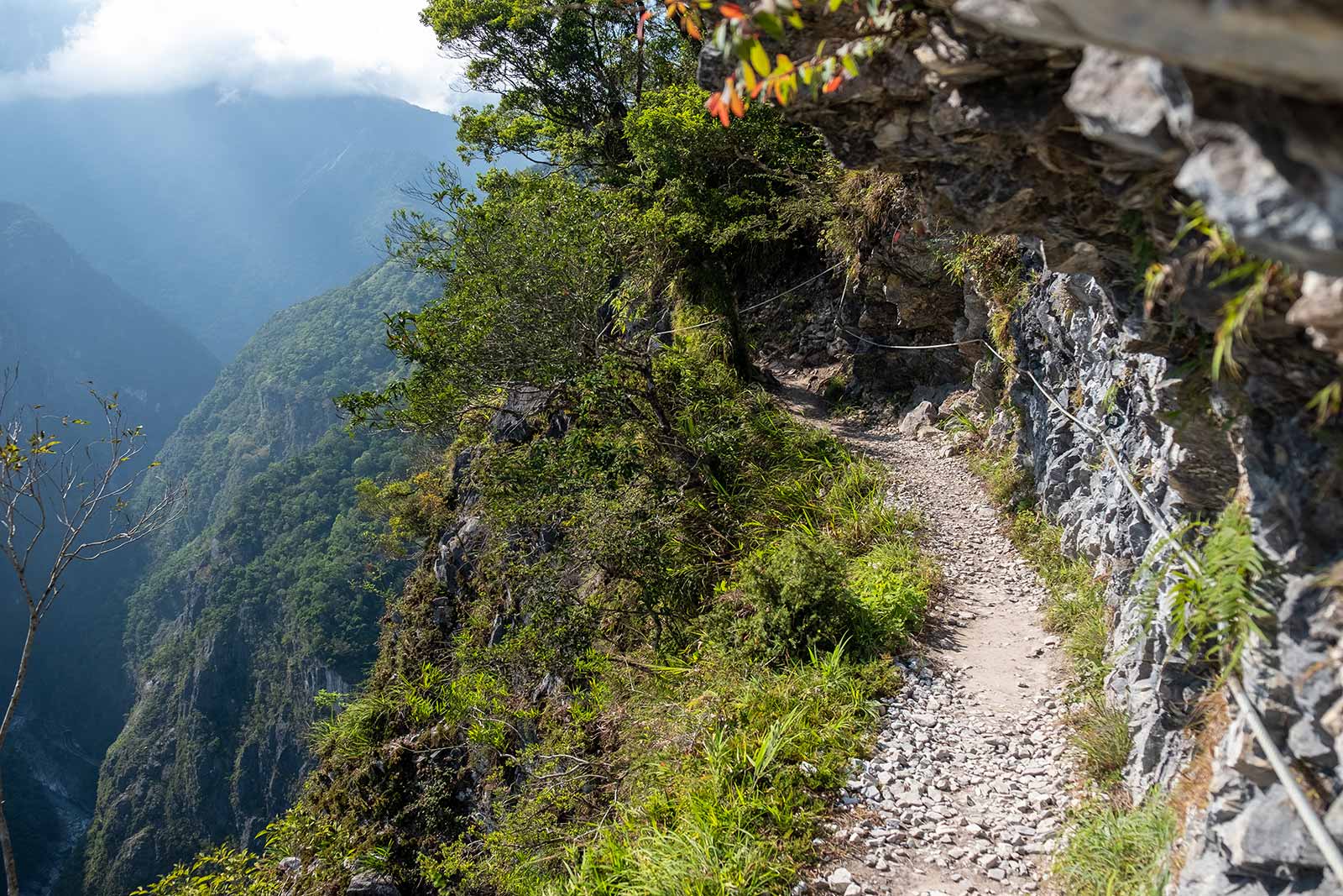
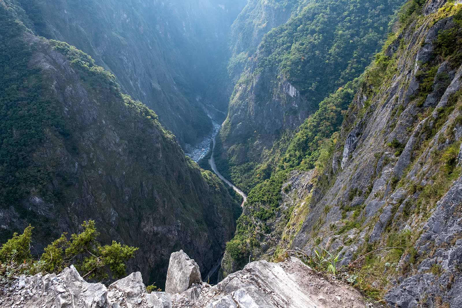
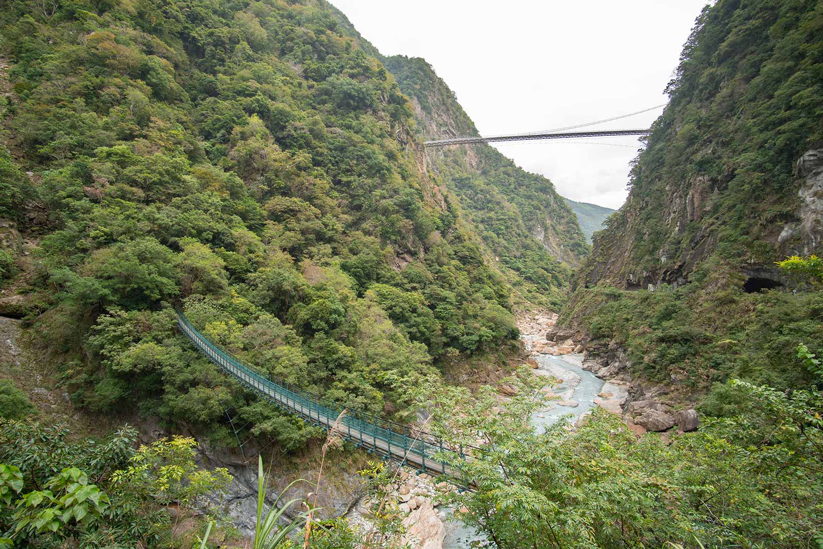
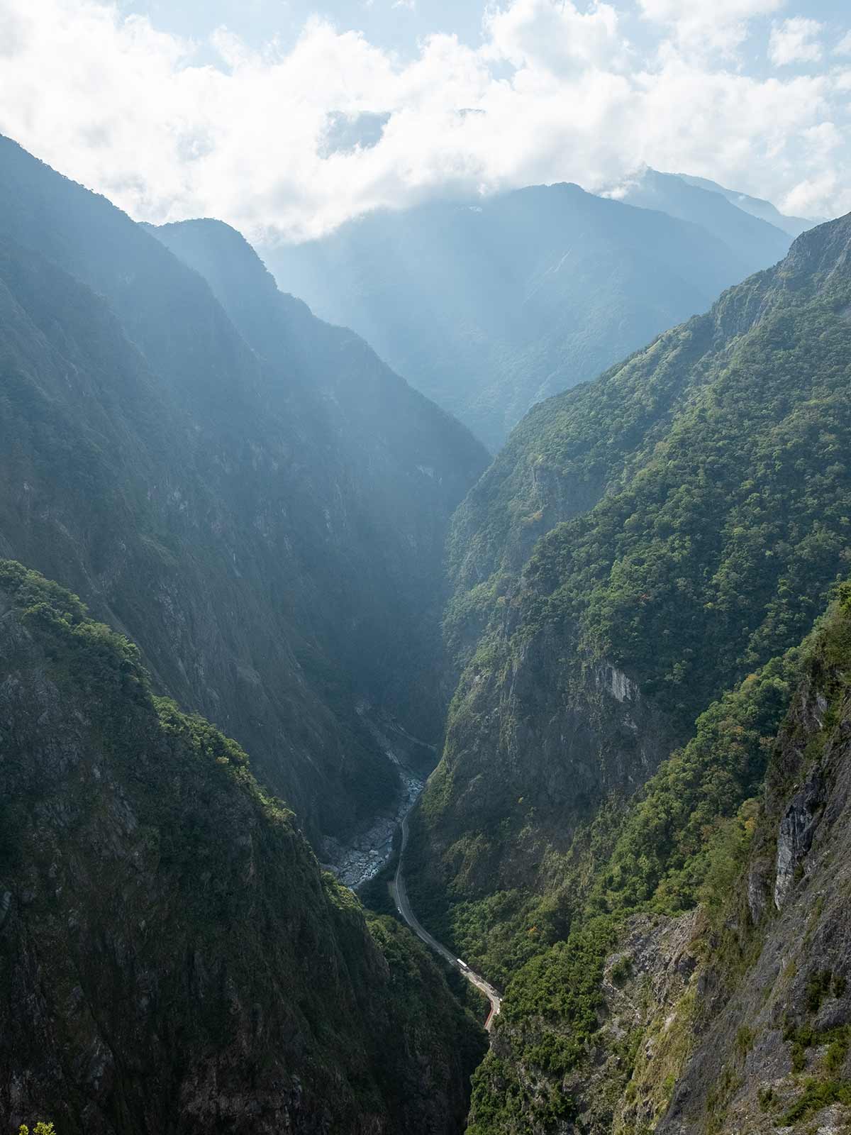
There’s nothing like peering into Taroko, the world’s longest marble canyon, from a nearly 500 meter cliff directly above it. Zhuilu Old Trail is Taroko National Park’s most popular trail for good reason, it offers unparalleled views and first-hand experiences of this natural wonder. It’s not for the faint of heart though, the final half kilometer involves a ledge walk where the ledge varies one meter or less in width.
The steep but manageable climb begins by crossing a suspension bridge just adjacent to Taroko National Park’s famous Swallow Grotto trail, then continues to skirt the northern face of Taroko. Enjoy indigenous settlements, the ruins of Japanese police stations, and dramatic suspension bridges as you climbs up to witness the best view that Taroko has to offer.
Yangmingshan in Taipei City and New Taipei City
A National Park in Taipei’s Backyard
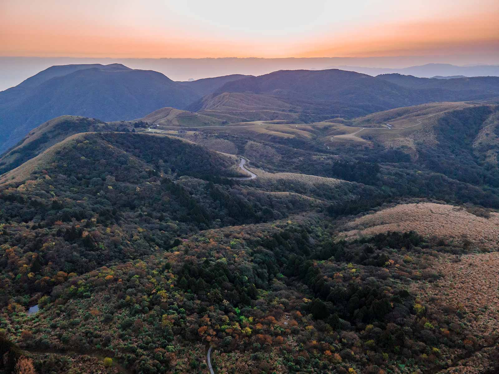
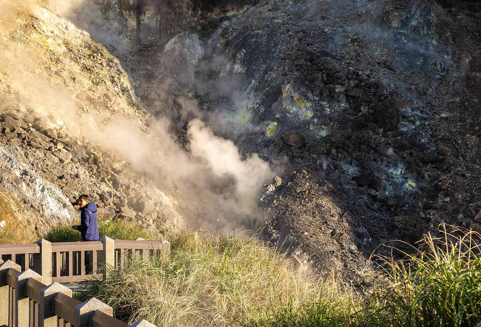
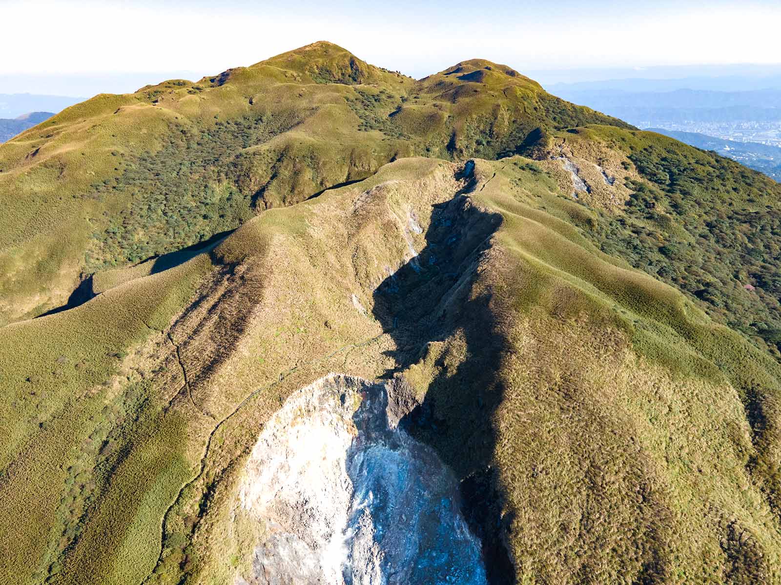
Yangmingshan National Park is located on a verdant volcano group known as the Datun Volcano Group, just a short distance from downtown Taipei. In total, the park features 20 or so volcanos, most of which are dormant, resulting in a safe natural playground full of post-volcanic attractions like hot springs, fumaroles, and other exciting geological features.
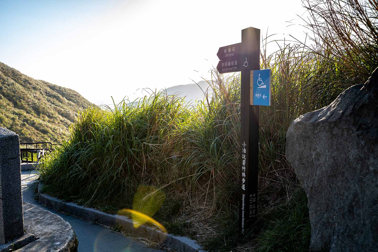
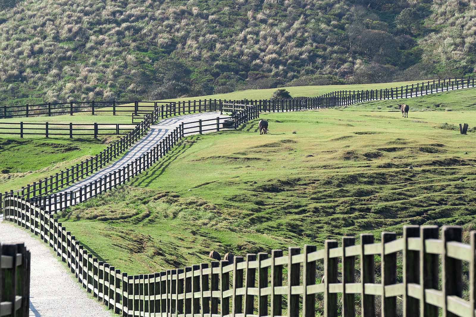
The park’s rolling hills, hot springs, and awe-inspiring volcanic landscapes have made it the number one destination for nature enthusiasts and day hikers from Taipei. Multiple hiking trails wind through the park’s lush forests and tranquil meadows, offering visitors multiple unique perspectives from which to take in the park’s natural beauty. Some trails, like Qingtiangang Loop Trail, cross rolling high-altitude meadows, others, like the Xiaoyoukeng Arrow Bamboo Trail, lead to steaming sulfur pits, yet others, like the Qixingshan Trail from Lengshuikeng, offer a challenge as they climb the highest park’s numerous grassy peaks.
Due to its elevation and proximity to Taipei, most trails in Yangmingshan National Park, as well as the roads leading up to the park, offer breathtaking views of the Taipei basin.
Suggested Trails: Xiaoyoukeng Arrow Bamboo Trail (easy/accessible), Qingtiangang Grassland (moderate), Mt. Datun (difficult)
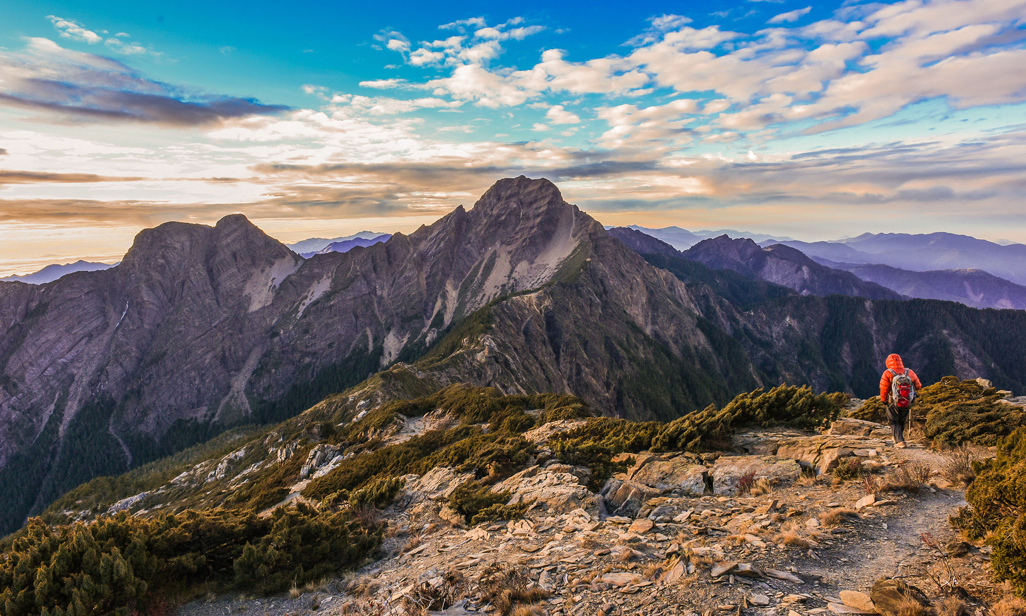
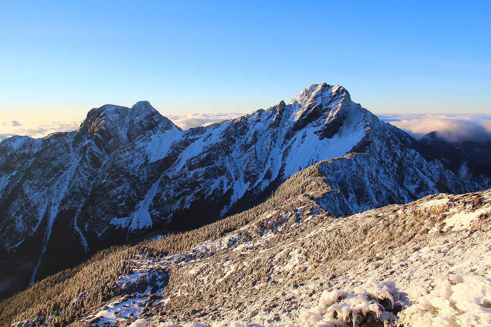
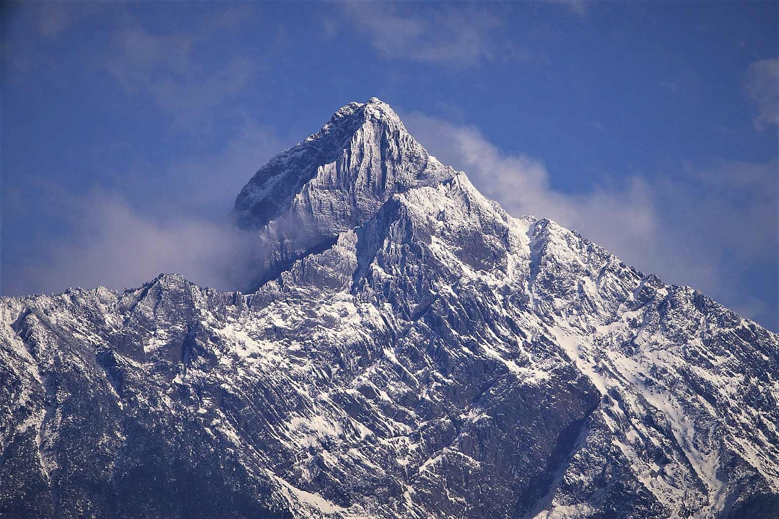
Mt. Yuanzui (Snow Mountain National Forest Park) in Heping District, Taichung City
Taiwan’s Most Beautiful Day Hike
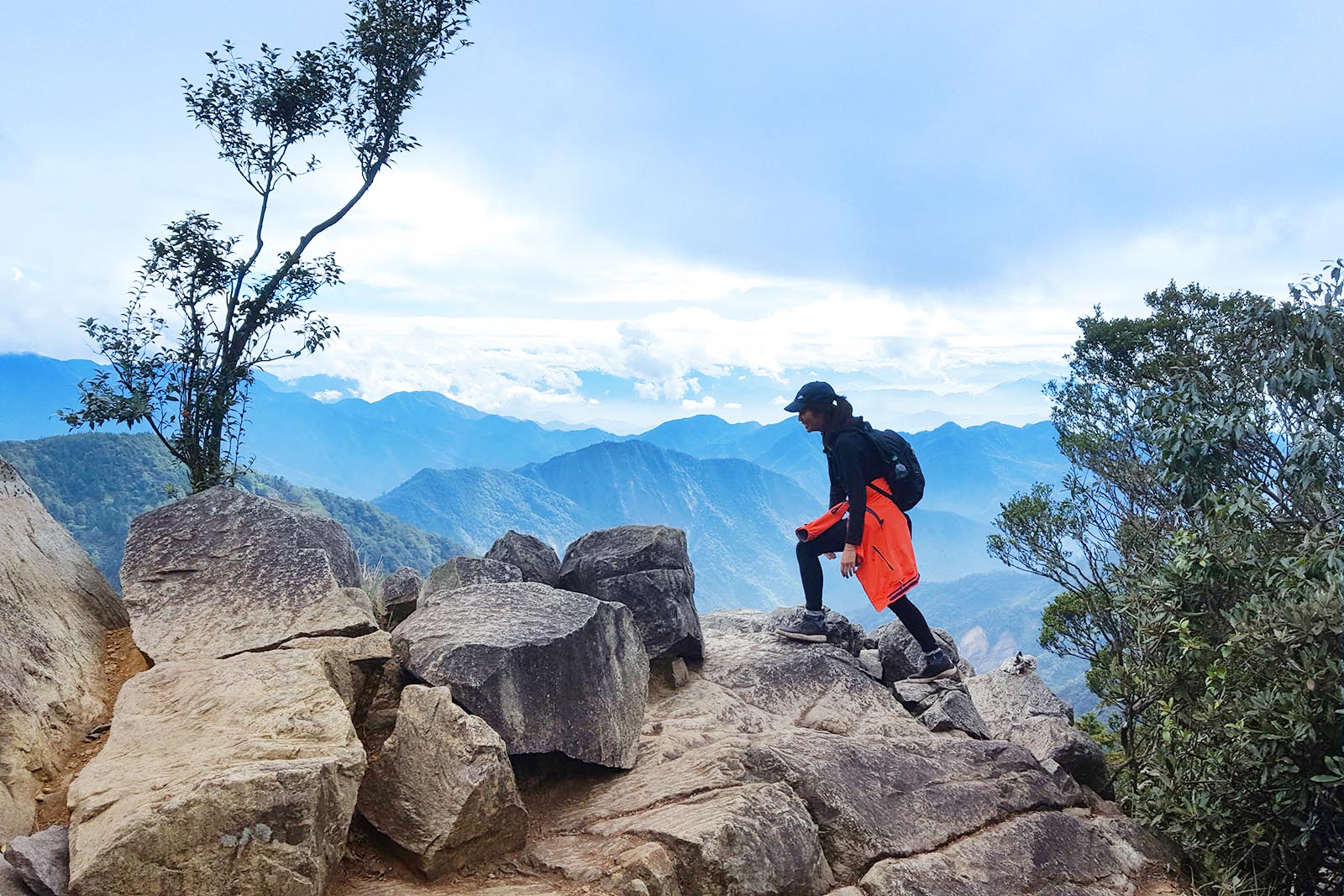
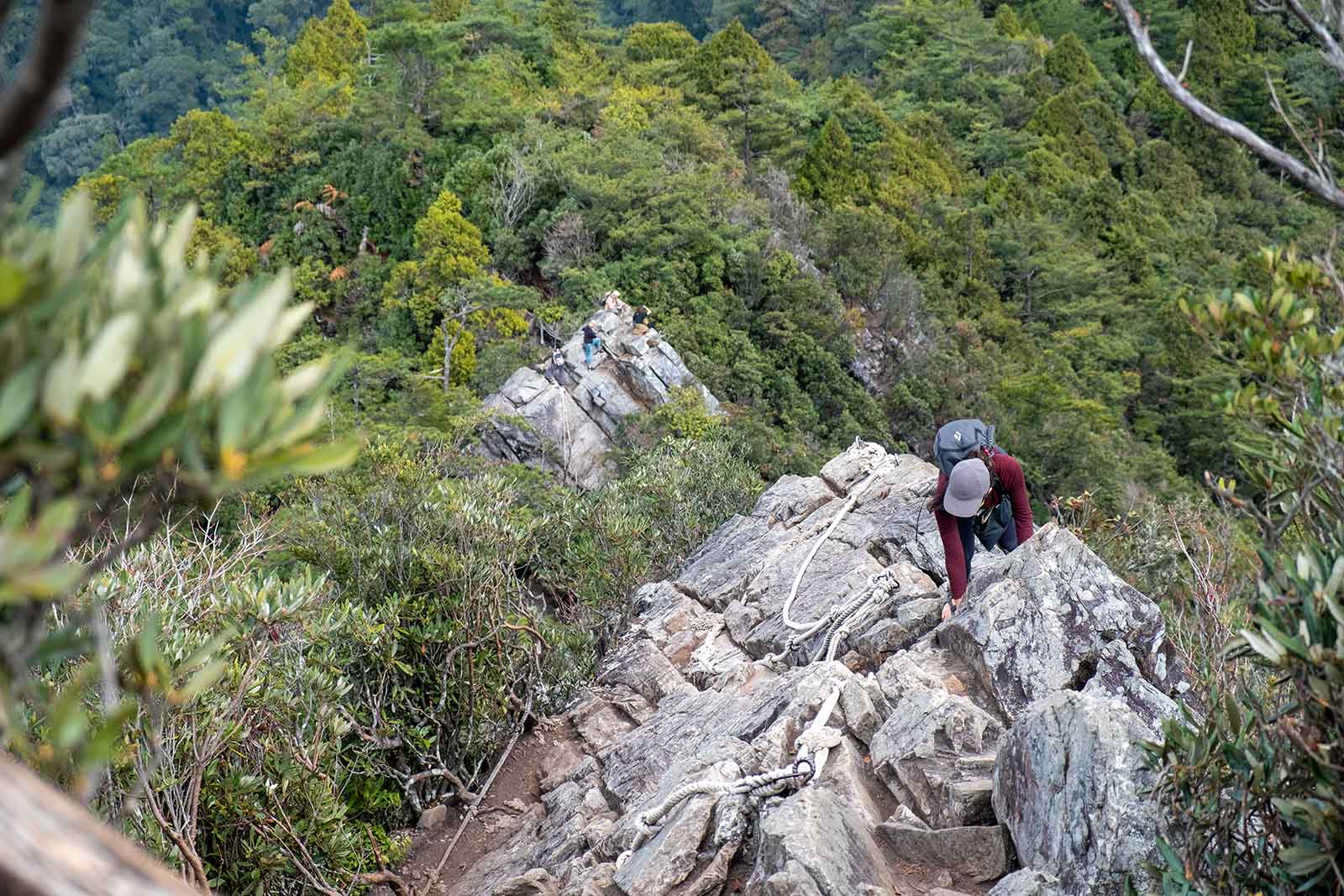
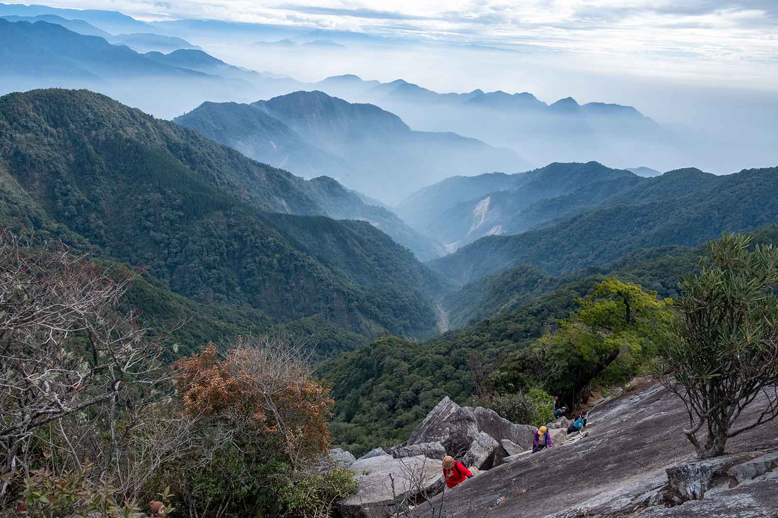

Simply put, this is Taiwan’s most technically challenging climb, most Instagrammable peak, and most rewarding day hike. Mt. Yuanzui’s hike begins and ends with ropes, and aside from a short section through a pine forest, is as close to a classic Italian via-ferrata as you can find in Taiwan. The final section includes ascending and descending a sheer rock face with iron rungs and thick rope for assistance. Once at the top, you are treated to one of Taiwan’s best panoramic views.
On good days, Taichung City and even the Taiwan Strait can be seen to the west, while Mt. Snow is visible to the East. Some of the island’s more eccentric locals (as well as aspiring photographers) like to climb the peak before sunrise or stay on the peak’s narrow ridge until dusk to watch the sun slowly set in the distance.
Mt. Jade (Yushan National Park) in Xinyi Township, Nantou County
Taiwan’s Highest Peak
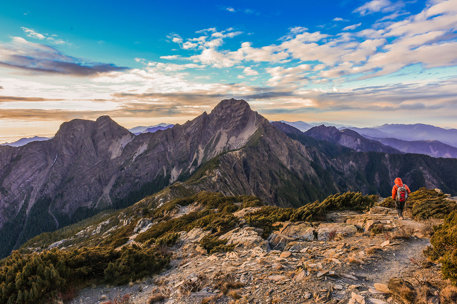
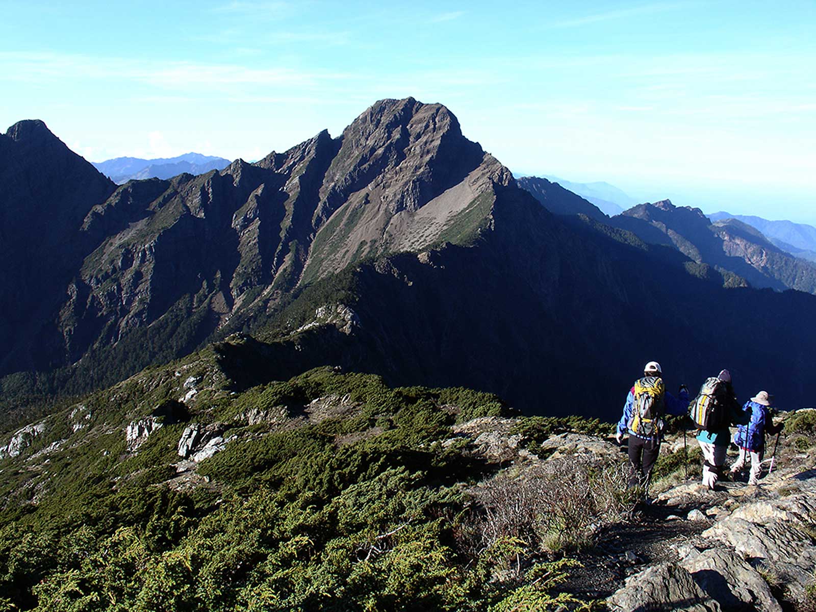
Mt. Jade’s summit is 3,952 meters (12,965 feet) above sea level, making it Taiwan’s highest peak and part of the Asian Trilogy of Asian Island Highpoints. Mt. Jade, also known as Jade Mountain and Yushan, features an alpine climate and receives snowfall between October and May. The hike is not easy and Mt. Jade is considered a once-in-a-lifetime destination by many Taiwanese mountaineers and international peakbaggers. The recently renovated Paiyun Mountain Lodge offers hikers warm meals and sleeping bag rental, making Jade Mountain one of Taiwan’s most accessible 3,000 meter peaks, also known as “Baiyue”. Most climbers choose to hike the mountain in 2 or 3 days to make the trip easier. Guide services are recommended.
Top attractions on the trail include panoramic views, overlapping mountain ranges, and the “sea of clouds” that, depending on wind direction on any given day, may crowd into the valleys below.
The Walami Trail (Yushan National Park) in Zhuoxi Township, Hualien County
A Gentle Stroll Into a Central Mountain Range Valley

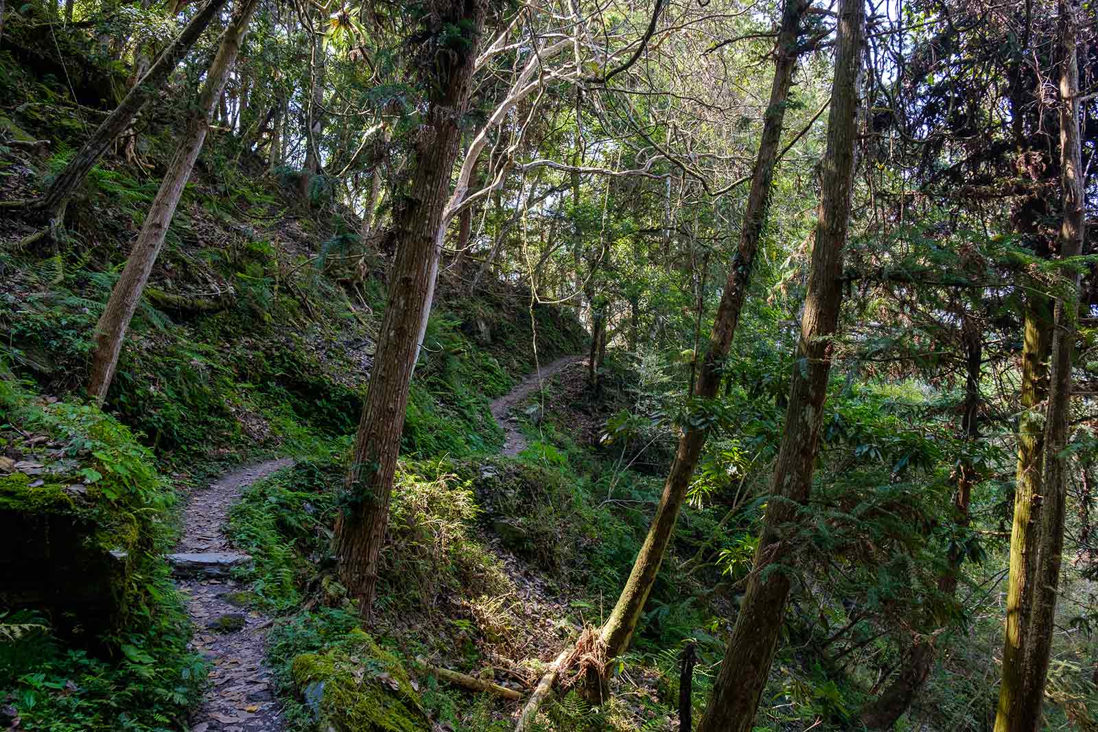

The Walami Trail is the East Coast’s most accessible and most rewarding hike, not to mention it offers visitors a chance to catch a glimpse of much of Yushan National Park’s unique flora and fauna. The Walami Trail is actually the eastern end of the Batongguan Traversing Trail, which extends just over 96 kilometers to Nantou County. The first 4 kilometers of the Walami Trail follow a flat path high above the Lele River Valley—one of Eastern Taiwan’s major river valleys–crossing many of the river’s tributaries via suspension bridges and offering unbeatable views of Taiwan’s wilderness.
The Batongguan Traversing Trail that forms the basis for the Walami Trail was built during the Japanese colonial era to serve as a cross-island police patrol path. The first 4 kilometers of the Walami Path do not require a permit, however, trekking further into the Batongguan Traversing Trail, and overnight trips require applying for park entry permits and cabin space in advance.